
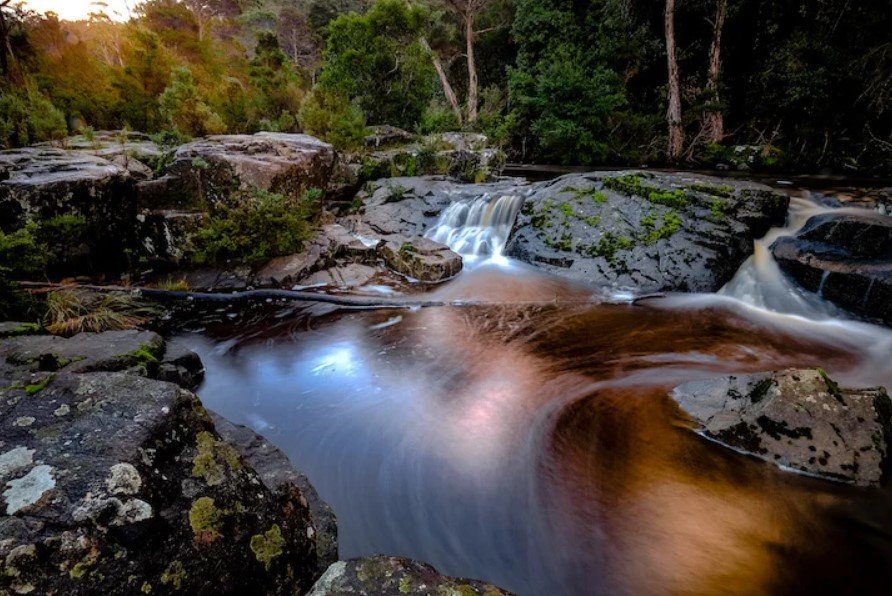
Tamar Valley is a scenic river valley in northern Tasmania, Australia, extending along the Tamar River from the outskirts of Launceston toward Bass Strait. The valley combines fertile farmland, vineyards, wetlands, historic settlements, and waterways, creating a landscape shaped by both agriculture and the river.
The area is particularly known for its cool-climate wine production, rural scenery, heritage towns, and access to the Tamar River. Its proximity to Launceston also makes it an accessible destination for travelers interested in Tasmania’s food, wine, history, nature, and countryside.
Tamar Valley Quick Facts
| Fact | Details |
|---|---|
| Location | Northern Tasmania, Australia |
| Country | Australia |
| Region | Northern Tasmania |
| Main Waterway | Tamar River |
| Elevation | Generally low-lying river valley with surrounding hills |
| Famous For | Vineyards, wine, farmland, river scenery and heritage |
| Climate | Cool temperate maritime |
| Best Months | Generally December to March |
| Nearby City/Town | Launceston |
Where Is Tamar Valley?
Tamar Valley is located in northern Tasmania, surrounding the Tamar River north of Launceston. The valley follows the river toward Bass Strait, with settlements and agricultural areas distributed along both sides of the waterway.
Launceston is the major nearby city and an important gateway to the region. Towns and communities associated with the valley include Legana, Rosevears, Exeter, Beaconsfield, Beauty Point and George Town.
Its position in northern Tasmania places it within relatively easy reach of Launceston and the state’s northern coastline, making it practical for both short excursions and longer countryside stays.
Geography and Landscape
The Tamar Valley is centered on the Tamar River, a tidal waterway formed by the junction of the North Esk and South Esk rivers at Launceston. From there, the waterway flows north through a broad landscape of hills, farmland, vineyards, forests, wetlands, and small settlements before reaching Bass Strait.
The valley is less enclosed by dramatic mountains than many of Tasmania’s inland valleys. Instead, rolling hills and river terraces characterize much of the landscape. The fertile soils and relatively mild climate have supported agriculture, orchards, and vineyards.
Wetlands and estuarine environments along the lower Tamar also provide important habitat for birds and other wildlife. The river itself is a defining geographical feature, linking the rural communities of the upper valley with the coastal environment farther north.
History of Tamar Valley
The Tamar Valley has a long Indigenous history associated with the Palawa people of Tasmania. Aboriginal communities lived throughout northern Tasmania for thousands of years before European settlement, developing extensive knowledge of the area’s waterways, plants, animals, and seasonal resources.
European exploration of the Tamar region began in the early nineteenth century, followed by settlement and agricultural development. The river became an important transportation route, helping connect emerging communities and agricultural properties with Launceston and coastal areas.
During the nineteenth century, settlements such as George Town, Exeter, Beaconsfield, and others developed around farming, river transport, timber, mining, and trade. The Tamar Valley’s agricultural character became increasingly established as European settlers cultivated crops and developed orchards and pastoral properties.
Mining also contributed to the region’s history. Beaconsfield, on the western side of the Tamar River, became particularly important because of its gold mine, which operated for more than a century and became one of Tasmania’s best-known mining sites.
How Was Tamar Valley Formed?
The Tamar Valley’s landscape reflects a combination of river erosion, sediment deposition, changing sea levels, and geological processes affecting northern Tasmania. The Tamar River occupies a broad valley and estuarine system rather than a narrow mountain gorge.
Over long periods, flowing water and changing environmental conditions shaped the valley’s hills, river terraces, wetlands, and floodplain areas. The tidal influence becomes increasingly important toward the river’s northern reaches, where freshwater and marine environments meet.
Tamar Valley Weather Throughout the Year
Tamar Valley has a cool temperate maritime climate. Conditions are generally milder than Tasmania’s highland areas, although temperatures can change quickly and rainfall occurs throughout the year.
January to March
Summer is generally the warmest period, with comfortable daytime temperatures and cooler evenings. January and February are particularly suitable for outdoor sightseeing, vineyard visits, walking, and exploring the valley’s towns.
April to June
Autumn brings cooler temperatures and changing colors across the rural landscape. Rainfall becomes more noticeable, and mornings and evenings can be chilly. April can still provide relatively pleasant conditions for outdoor activities.
July to September
Winter is cool and often wetter. Frost can occur, particularly in inland and elevated areas, while daytime conditions are generally mild to cool. Snow is uncommon in the lower valley itself.
October to December
Spring brings gradually warmer temperatures, longer daylight hours, and renewed growth across vineyards, orchards, and farmland. By December, conditions become increasingly suitable for outdoor exploration.
Best Weather for Visiting Tamar Valley
December through March generally offers the warmest and most comfortable conditions for exploring Tamar Valley, particularly for vineyard visits, river activities, sightseeing, and outdoor dining. Autumn can also be appealing for travelers interested in changing foliage and the quieter countryside atmosphere.
Things to Do in Tamar Valley
Visit Local Vineyards
Wine tasting is one of the region’s signature experiences. Visitors can explore cellar doors and sample cool-climate wines produced from grapes grown throughout the valley.
Explore the Tamar River
The river provides opportunities for sightseeing, boating, fishing, and enjoying views of the surrounding countryside. River cruises are another way to experience the landscape from the water.
Discover Heritage Towns
Small communities throughout the valley contain historic buildings, galleries, local businesses, and reminders of Tasmania’s agricultural and mining past.
Enjoy Local Food
The valley’s vineyards, farms, orchards, and producers contribute to a strong food culture. Visitors can combine wine tasting with locally produced cheeses, fruits, seafood, and other Tasmanian products.
Go Birdwatching
Wetlands and river habitats provide opportunities to observe waterbirds and other species, particularly around quieter sections of the Tamar estuary.
Explore the Countryside
Driving through the valley is an enjoyable way to experience its vineyards, farmland, river views, and rural settlements at a relaxed pace.
Famous Attractions in and Around Tamar Valley
Tamar Island Wetlands
Located near Launceston, Tamar Island Wetlands is an important natural area featuring walking trails, wetlands, bird habitat, and views across the Tamar River environment.
Beaconsfield Mine & Heritage Centre
The Beaconsfield Mine & Heritage Centre preserves the area’s mining story and explains the development of the former gold-mining community.
Seahorse World
Located at Beauty Point, Seahorse World is a marine attraction focused on seahorses and other marine life associated with Tasmania’s waters.
Platypus House
Also at Beauty Point, Platypus House provides an opportunity to learn about and observe platypuses and echidnas in a dedicated setting.
George Town
One of Tasmania’s historic settlements, George Town sits near the mouth of the Tamar River and provides access to the northern end of the valley and Bass Strait.
Batman Bridge
The Batman Bridge crosses the Tamar River and is an important transport link between the eastern and western sides of the valley. Its location also provides an impressive perspective over the river landscape.
Mount George Lookout
Near the northern part of the valley, elevated viewpoints provide broad views across the Tamar River, surrounding farmland, and coastal landscape.
Wildlife and Nature
The Tamar Valley contains a mixture of river, wetland, woodland, farmland, and estuarine habitats. These environments support numerous bird species, including waterbirds that use the wetlands and tidal sections of the Tamar River.
The region is also home to native Tasmanian mammals such as wallabies, possums, wombats, and echidnas. The Tamar Island Wetlands are particularly valuable for wetland biodiversity and birdlife.
Conservation areas along the river help protect habitats from development and maintain ecological connections between freshwater, terrestrial, and coastal environments.
How to Reach Tamar Valley
Launceston is the main gateway to Tamar Valley and has a regional airport with domestic connections. From Launceston, the southern part of the valley can be reached by road within a short drive.
The East Tamar Highway and West Tamar Highway provide the principal road connections along the eastern and western sides of the river. Driving is the most practical way to explore the valley because many vineyards, rural attractions, and small communities are spread across the region.
Public transport is more limited outside the larger settlements, so travelers planning to visit several attractions generally benefit from having access to a car.
Where to Stay Near Tamar Valley
Accommodation is available throughout the valley and in nearby Launceston. Visitors can choose from vineyard stays, country cottages, bed-and-breakfast properties, guesthouses, hotels, and holiday accommodation.
Launceston offers the widest selection of conventional accommodation and is convenient for travelers who want city facilities while making day trips into the valley. Smaller communities such as Rosevears, Exeter, Beauty Point, and George Town provide a quieter countryside or riverside experience.
Why Is Tamar Valley Famous?
Tamar Valley is best known for its vineyards, cool-climate wines, picturesque river landscape, fertile agricultural land, historic communities, and combination of rural and coastal environments. Its proximity to Launceston makes it one of northern Tasmania’s most accessible countryside regions.
Tamar Valley FAQs
Where is Tamar Valley located?
Tamar Valley is in northern Tasmania, Australia, following the Tamar River north from Launceston toward Bass Strait.
What is Tamar Valley famous for?
The valley is particularly known for cool-climate vineyards and wine, agricultural landscapes, historic towns, river scenery, and food experiences.
What is the weather like in Tamar Valley?
The region has a cool temperate maritime climate, with mild to warm summers, cool winters, and rainfall spread across the year.
What are the best months to visit Tamar Valley?
December through March generally provides the warmest conditions, while autumn can also be attractive for cooler weather and changing countryside scenery.
What can you do in Tamar Valley?
Visitors can explore vineyards, taste local food and wine, enjoy the Tamar River, visit heritage attractions, explore wetlands, and discover historic towns.
How do you reach Tamar Valley?
Launceston is the main gateway. The valley can be explored by road using the East Tamar Highway and West Tamar Highway.
Does Tamar Valley get snow?
Snow is uncommon in the lower parts of the valley. Winter temperatures can be cold, but substantial snowfall is more associated with Tasmania’s higher elevations.
What attractions are near Tamar Valley?
Popular attractions include Tamar Island Wetlands, Beaconsfield Mine & Heritage Centre, Seahorse World, Platypus House, George Town, and Batman Bridge.
Final Thoughts
Tamar Valley offers a distinctive combination of river scenery, vineyards, fertile countryside, wildlife habitats, and Tasmania’s rich agricultural and settlement history. Its accessible location near Launceston and varied attractions make it an appealing destination for travelers interested in exploring northern Tasmania at a relaxed pace.
For More Visit Stay And Update
