
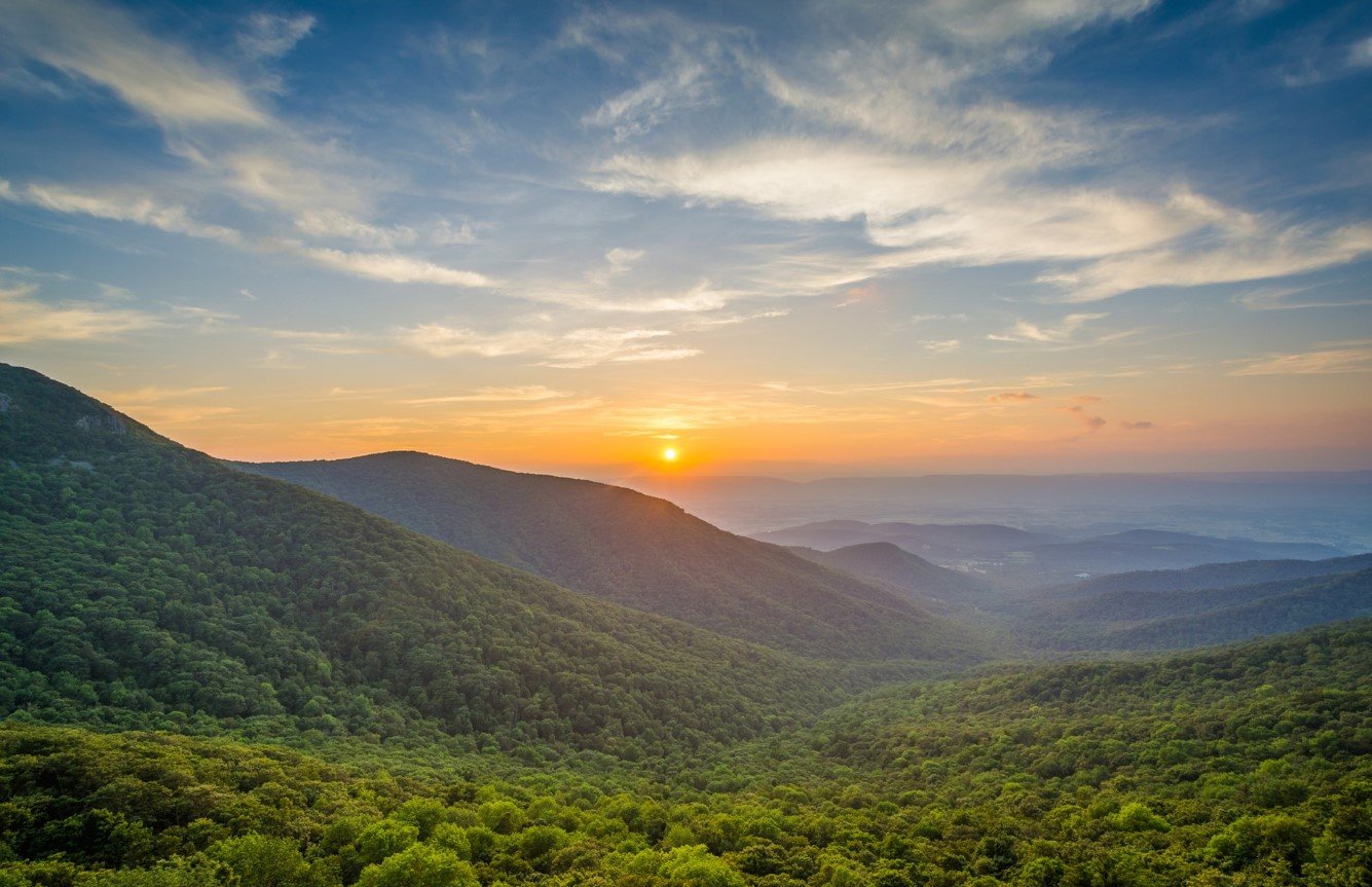
Shenandoah Valley is a long, scenic valley in the eastern United States, stretching between the Blue Ridge Mountains to the east and the Allegheny Mountains to the west. Best known for its fertile farmland, historic communities, limestone landscapes, and mountain scenery, the valley has played an important role in the agricultural and cultural history of Virginia and West Virginia.
The valley is also closely associated with the Shenandoah River and the historic settlements that developed along its waterways and fertile soils. Today, visitors come for hiking, scenic drives, Civil War history, local farms, outdoor recreation, and access to attractions including Shenandoah National Park and the Blue Ridge Parkway.
| Fact | Details |
|---|---|
| Location | Virginia and West Virginia, United States |
| Country | United States |
| Region | Appalachian Mountains |
| Elevation | Varies considerably across the valley |
| Famous For | Mountains, farmland, history, Shenandoah River and scenic landscapes |
| Climate | Humid subtropical with four distinct seasons |
| Main River | Shenandoah River |
| Best Months | April to October |
| Nearby Cities/Towns | Winchester, Harrisonburg, Staunton, Lexington |
Where Is Shenandoah Valley?
The Shenandoah Valley lies between the Blue Ridge Mountains on the east and the Allegheny Mountains on the west. Most of the valley is in Virginia, although its northern portion extends into West Virginia.
The region stretches for roughly 150 miles from the Potomac River area near Harpers Ferry southward toward the James River Valley. Major communities include Winchester, Front Royal, Woodstock, Harrisonburg, Staunton, and Lexington. Interstate 81 follows much of the valley’s length, making it one of the easiest Appalachian valleys to explore by road.
Geography and Landscape
Shenandoah Valley is part of the Great Valley of the Appalachian Mountains, a large geographic system extending through several eastern states. Its landscape consists of rolling agricultural land, limestone and karst formations, wooded hills, rivers, streams, and surrounding mountain ridges.
The Shenandoah River is the valley’s defining waterway. It consists primarily of the North Fork and South Fork, which eventually join and flow north toward the Potomac River. The fertile soils and relatively broad valley floor have supported agriculture for centuries, particularly livestock, dairy farming, corn, and other crops.
The Blue Ridge Mountains form the eastern boundary, while the Massanutten Mountain ridge divides portions of the valley into distinct geographic areas. Limestone geology has also contributed to caves, springs, sinkholes, and other karst features.
History of Shenandoah Valley
The Shenandoah Valley has a long Indigenous history. Native peoples used and traveled through the region long before European settlement, and the valley’s rivers and fertile lands made it an important corridor through the Appalachian Mountains.
European settlement increased during the eighteenth century. German, Scots-Irish, and other settlers established farms and communities, transforming the valley into one of the major agricultural regions of the colonial and early American South. The Great Wagon Road became an important route for migration into the southern Appalachian frontier.
During the American Civil War, the valley became strategically important because of its agricultural production and its location between major military centers. Numerous campaigns and battles took place here, including the 1862 Valley Campaign and the 1864 Shenandoah Valley Campaign. The valley’s farms supplied food to Confederate forces, making control of the region economically and militarily significant.
After the war, agriculture remained central to the local economy while towns expanded through transportation, manufacturing, education, and commerce. In the twentieth century, tourism increasingly became an important part of the valley’s economy.
How Was Shenandoah Valley Formed?
The Shenandoah Valley developed through a combination of ancient geological processes, erosion, folding, faulting, and the weathering of sedimentary rocks. Much of the valley consists of relatively softer limestone and other sedimentary formations that eroded more easily than the harder rocks forming the surrounding mountain ridges.
Over millions of years, erosion gradually created the broad valley between the Blue Ridge and Allegheny ranges. Rivers and streams continued to shape the landscape, while limestone dissolution produced the caves, springs, and sinkholes characteristic of parts of the region.
Shenandoah Valley Weather Throughout the Year
The Shenandoah Valley has four distinct seasons. Conditions vary with elevation and location, but the valley generally experiences warm summers, cool winters, and precipitation throughout the year.
January to March
Winter is generally cool, with occasional snow and freezing conditions. January and February are typically the coldest months, while temperatures begin rising during March. Higher mountain areas are colder and may retain snow longer.
April to June
Spring brings warmer temperatures, flowering plants, green farmland, and increased outdoor activity. April can still be cool, while May and June are generally mild to warm. Rainfall is possible throughout the season.
July to September
Summer is warm and often humid. July and August are typically the hottest months, with daytime temperatures frequently reaching the 80s°F (upper 20s°C). September usually brings gradually cooler conditions.
October to December
Autumn is known for cooler temperatures and colorful foliage, particularly in the surrounding mountain forests. November becomes noticeably colder, while December brings more frequent freezing conditions and occasional snow.
Best Weather for Visiting Shenandoah Valley
April through October generally offers the broadest range of comfortable conditions for exploring the valley. Spring is ideal for fresh greenery and outdoor activities, while October is particularly popular for fall foliage and scenic drives.
Things to Do in Shenandoah Valley
- Hiking: Trails throughout the valley and surrounding mountains range from short walks to demanding backcountry routes.
- Scenic driving: Skyline Drive and other mountain roads provide opportunities to explore the region by car.
- Canoeing and kayaking: Sections of the Shenandoah River are suitable for paddling and water-based recreation.
- Fishing: The area’s rivers and streams provide opportunities for freshwater fishing.
- Cycling: Rural roads and established trails offer routes through farmland and mountain scenery.
- Wildlife watching: Forests, fields, and waterways support numerous bird and animal species.
- Historical sightseeing: Battlefields, historic towns, museums, and preserved buildings provide insight into the valley’s past.
Famous Attractions in and Around Shenandoah Valley
Shenandoah National Park
Located along the Blue Ridge Mountains, Shenandoah National Park contains forests, waterfalls, hiking trails, wildlife habitat, and Skyline Drive.
Skyline Drive
This scenic road runs through Shenandoah National Park along the crest of the Blue Ridge Mountains and provides numerous overlooks across the valley.
Luray Caverns
Luray Caverns is a large limestone cave system near Luray, Virginia, known for its underground chambers, formations, and extensive cave passages.
Natural Bridge State Park
Natural Bridge is a major geological landmark in Virginia where a massive limestone arch rises above Cedar Creek.
Harpers Ferry
Located near the northern end of the valley, Harpers Ferry is a historic town at the confluence of the Shenandoah and Potomac rivers, with strong connections to American history.
New Market Battlefield
New Market Battlefield State Historical Park preserves the site of the 1864 Battle of New Market, an important event in the Civil War’s Shenandoah Valley Campaign.
Frontier Culture Museum
Located near Staunton, the Frontier Culture Museum explores the experiences of immigrants who settled in the Shenandoah Valley during the eighteenth century.
George Washington National Forest
Large areas of forest surrounding the valley provide opportunities for hiking, camping, fishing, and wildlife observation.
Wildlife and Nature
The valley’s combination of farmland, forests, rivers, wetlands, and mountain habitats supports a diverse range of wildlife. White-tailed deer, wild turkey, black bears, foxes, raccoons, and numerous bird species occur throughout the broader Shenandoah region.
The Shenandoah River and its tributaries provide aquatic habitat, while the surrounding forests support oak, hickory, maple, pine, and other native vegetation. Protected areas such as Shenandoah National Park and the George Washington National Forest help conserve large portions of the region’s natural landscape.
How to Reach Shenandoah Valley
Shenandoah Valley is highly accessible by road. Interstate 81 runs north-south through much of the region, connecting communities including Winchester, Harrisonburg, Staunton, and Lexington. Interstate 64 provides an important east-west connection near the southern part of the valley.
The nearest airports vary according to the destination. Shenandoah Valley Regional Airport near Weyers Cave provides commercial air service for the central valley, while larger airports such as Washington Dulles International Airport and Charlottesville-Albemarle Airport serve travelers approaching from farther away.
Amtrak service is available at several locations in the broader region, including stations near the northern and eastern edges of the valley.
Where to Stay Near Shenandoah Valley
Accommodation is available throughout the valley, with the largest selection generally found in communities such as Winchester, Harrisonburg, Staunton, and Lexington. Visitors can choose from hotels, inns, bed-and-breakfasts, vacation rentals, cabins, and campgrounds.
Those prioritizing outdoor recreation may prefer lodging near Shenandoah National Park or the George Washington National Forest, while travelers interested in history and local culture may choose one of the valley’s established towns.
Why Is Shenandoah Valley Famous?
Shenandoah Valley is famous for its combination of Appalachian scenery, fertile farmland, historic communities, Civil War sites, limestone landscapes, and outdoor recreation. Its location between major mountain ranges also made it an important migration corridor and strategic landscape throughout American history.
Shenandoah Valley FAQs
Where is Shenandoah Valley located?
Shenandoah Valley is primarily in Virginia, with its northern end extending into West Virginia. It lies between the Blue Ridge Mountains and Allegheny Mountains.
What is Shenandoah Valley famous for?
The valley is known for its farmland, Shenandoah River, mountain scenery, Civil War history, historic towns, caves, and outdoor recreation.
What is the weather like in Shenandoah Valley?
The valley has four distinct seasons, with cool winters, mild springs, warm and humid summers, and colorful autumns.
What are the best months to visit Shenandoah Valley?
April through October generally provides favorable conditions. October is especially popular for autumn foliage, while spring offers mild weather and fresh vegetation.
What can you do in Shenandoah Valley?
Popular activities include hiking, scenic driving, kayaking, fishing, cycling, wildlife watching, camping, and visiting historic sites.
How do you reach Shenandoah Valley?
Interstate 81 is the principal north-south highway through the region, with Interstate 64 providing an important east-west connection. Regional airports and rail services provide additional access.
Does Shenandoah Valley get snow?
Yes. Snow occurs during winter, although amounts vary considerably from year to year and are generally greater at higher elevations in the surrounding mountains.
What attractions are near Shenandoah Valley?
Major attractions include Shenandoah National Park, Skyline Drive, Luray Caverns, Natural Bridge, Harpers Ferry, New Market Battlefield, and the Frontier Culture Museum.
Final Thoughts
Shenandoah Valley combines fertile agricultural landscapes, Appalachian mountains, historic communities, rivers, forests, and important cultural sites. Its varied scenery and four-season climate make it a destination suited to travelers interested in nature, history, outdoor recreation, and the heritage of the eastern United States.
For More Visit Stay And Update
