
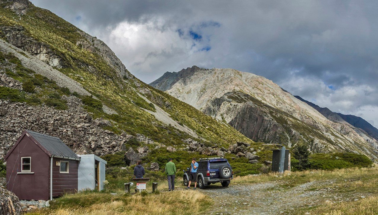
Godley Valley is a remote alpine valley in New Zealand’s South Island, extending through the Southern Alps toward the upper reaches of Lake Tekapo. It is known for dramatic mountain scenery, braided rivers, glaciers, and a wilderness setting that has remained relatively undeveloped compared with New Zealand’s more accessible tourist destinations.
The valley forms part of the wider Mackenzie Basin and Aoraki/Mount Cook region, with the Godley River providing its principal watercourse. Its combination of high mountains, glacial landscapes, open river flats, and limited road access makes it particularly appealing to experienced hikers, backcountry travelers, photographers, and people interested in New Zealand’s natural geography.
Godley Valley Quick Facts
| Fact | Details |
|---|---|
| Location | Canterbury, South Island, New Zealand |
| Country | New Zealand |
| Region | Mackenzie Basin / Southern Alps |
| Elevation | Varies considerably from valley floor to surrounding mountains |
| Main River | Godley River |
| Famous For | Glaciers, mountains, braided rivers and remote wilderness |
| Climate | Cool alpine climate |
| Best Months | Generally November to March |
| Nearby Town | Twizel |
| Nearby Lake | Lake Tekapo |
Where Is Godley Valley?
Godley Valley is located in the Canterbury region of New Zealand’s South Island, on the eastern side of the Southern Alps. The valley stretches northward from the head of Lake Tekapo toward the high mountain country around the Godley Glacier and the upper Godley River.
The nearest major settlement for travelers approaching the region is Twizel, while Lake Tekapo is another important nearby destination. Much of the valley itself is remote and lies within the wider conservation landscape of the Mackenzie Basin and Aoraki/Mount Cook region.
Geography and Landscape
The valley is dominated by the Godley River, a large braided river system fed by glaciers and seasonal snowmelt. Its broad gravel flats contrast sharply with the steep mountains and glaciated terrain surrounding the upper valley.
Several significant glaciers occur in the headwaters, including Godley Glacier. The surrounding Southern Alps contain rugged peaks, snowfields, scree slopes, and ice-carved valleys. As the river moves downstream, it carries sediment from the mountains and creates constantly changing braided channels across the valley floor.
The landscape is largely open rather than densely forested, reflecting the region’s cool climate, elevation, exposure, and relatively dry conditions on the eastern side of the Southern Alps.
History of Godley Valley
The wider Mackenzie Basin has a long Māori history, with Ngāi Tahu having strong historical and cultural connections throughout the South Island. Māori traditionally traveled through the region and used its resources as part of wider seasonal journeys.
European exploration and pastoral development later changed the Mackenzie Basin. The surrounding country became associated with large sheep stations, while rivers and mountain passes provided routes into increasingly remote parts of the Southern Alps.
The Godley Valley remained much less developed than lower agricultural areas because of its rugged terrain and difficult access. Its conservation and wilderness values have consequently become an important part of the valley’s modern identity.
How Was Godley Valley Formed?
Godley Valley was shaped primarily by glacial erosion and river processes. During past ice ages, large glaciers moved through the Southern Alps, excavating and widening valleys in the underlying rock.
As the glaciers retreated, they left behind broad valley floors, moraines, sediment deposits, and steep mountain walls. Today, glaciers and the Godley River continue to reshape the landscape by transporting rock and sediment downstream.
Godley Valley Weather Throughout the Year
Godley Valley has a cool alpine climate with rapidly changing conditions. Weather varies considerably with elevation, and conditions can become much colder and more severe toward the glacier-covered upper valley.
January to March
Summer provides the warmest conditions of the year. Lower parts of the valley can experience mild daytime weather, but temperatures fall quickly after sunset. Mountain weather can change rapidly, with strong winds, cloud, and rain possible.
April to June
Autumn brings cooler temperatures and shorter days. Snow becomes increasingly likely at higher elevations, while rainfall and changing mountain conditions can make backcountry travel more challenging.
July to September
Winter is cold, with snow and ice common throughout the upper valley and surrounding mountains. Higher elevations remain heavily snow-covered, and access can become difficult because of winter conditions.
October to December
Spring brings gradually rising temperatures and melting snow and ice. River levels can increase as seasonal snowmelt contributes to the braided river system. Higher mountain areas can continue to experience winter-like conditions well into spring.
Best Weather for Visiting Godley Valley
November through March generally offers the most practical conditions for exploring the valley, with longer daylight hours and milder temperatures. Even during summer, visitors should be prepared for rapid changes in alpine weather.
Things to Do in Godley Valley
Backcountry Hiking
The valley provides opportunities for multi-day hiking and wilderness travel, particularly for experienced visitors comfortable with remote terrain and changing conditions.
Scenic Photography
Mountain peaks, braided river channels, glaciers, and wide open valley floors create excellent subjects for landscape photography.
Trekking and Camping
The remote character of the valley makes it suitable for multi-day journeys involving backcountry camping. Travelers need appropriate equipment and strong preparation because services are extremely limited.
Glacier Viewing
The upper valley provides opportunities to see glacial landscapes and the river systems created by melting ice.
Wildlife Observation
Visitors can observe native and alpine birdlife while traveling through the valley’s open landscapes and river environments.
Scenic Flightseeing
Helicopter and aircraft operations in the wider Southern Alps provide another way to experience the area’s glaciers and mountain terrain, subject to weather and operator availability.
Famous Attractions in and Around Godley Valley
Godley Glacier
Godley Glacier is one of the valley’s defining geographical features. It feeds the upper Godley River and forms part of the extensive glacial environment of the Southern Alps.
Godley River
The braided Godley River runs through the valley, carrying glacial sediment toward Lake Tekapo and creating a constantly changing network of channels.
Lake Tekapo
Lake Tekapo lies at the southern end of the wider Godley Valley system. Its turquoise-blue water and surrounding mountain scenery make it one of the region’s best-known natural landmarks.
Southern Alps
The mountains surrounding the valley form part of New Zealand’s principal alpine range, with numerous high peaks, glaciers, snowfields, and rugged ridges.
Mackenzie Basin
The broader Mackenzie Basin provides a dramatic contrast between open grasslands, glacial lakes, rivers, and the surrounding high mountains.
Aoraki/Mount Cook Region
The wider Aoraki/Mount Cook landscape lies west of the valley and contains some of New Zealand’s highest mountains and largest glaciers.
Wildlife and Nature
Godley Valley contains a mixture of braided river habitats, alpine grasslands, rocky slopes, wetlands, and glacial environments. The vegetation becomes increasingly sparse toward higher elevations, where cold temperatures, snow, and exposed terrain limit plant growth.
Native birds associated with the wider South Island alpine environment can occur in the region, while river margins and wetlands provide habitat for additional birdlife. The valley’s relatively undeveloped character makes conservation of its waterways, vegetation, and wildlife habitats particularly important.
How to Reach Godley Valley
Godley Valley is not a conventional drive-in tourist destination. The southern portion can be approached from the Lake Tekapo area, but reaching the remote upper valley generally requires a combination of hiking, four-wheel-drive access on permitted routes, or an organized backcountry or flight-based journey.
Twizel is one of the nearest service towns and provides a useful base for preparing for travel into the surrounding mountain country. There is no regular rail service running into the valley itself, and visitors should not expect normal urban-style public transportation within the remote areas.
Where to Stay Near Godley Valley
There are no large accommodation developments deep inside the valley. Visitors commonly stay in nearby communities such as Twizel and Lake Tekapo, where hotels, lodges, holiday homes, motels, and campgrounds are available.
Backcountry travelers may use designated huts and campsites where permitted, but these facilities are basic and require appropriate preparation. Accommodation and hut availability should be checked before starting a remote journey.
Why Is Godley Valley Famous?
Godley Valley is recognized for its remote Southern Alps setting, extensive glacial landscape, braided river system, and dramatic combination of mountains, ice, and open valley terrain. Its relative isolation gives it a distinctly wild character compared with New Zealand’s more developed alpine destinations.
Godley Valley FAQs
Where is Godley Valley located?
Godley Valley is in Canterbury on New Zealand’s South Island, extending north from the head of Lake Tekapo into the Southern Alps.
What is Godley Valley famous for?
It is particularly known for the Godley River, Godley Glacier, surrounding mountains, braided river flats, and remote alpine wilderness.
What is the weather like in Godley Valley?
The valley has cool alpine conditions with significant weather changes. Summers are generally milder, while winter brings snow and much colder conditions, especially at higher elevations.
What are the best months to visit Godley Valley?
November through March generally provides the most favorable conditions for backcountry travel because of longer days and milder weather.
What can you do in Godley Valley?
Popular experiences include hiking, trekking, camping, photography, glacier viewing, wildlife observation, and scenic flights in the wider region.
How do you reach Godley Valley?
Access is limited compared with major tourist destinations. Travelers generally approach through the Lake Tekapo and Mackenzie Basin area, with remote sections requiring hiking, suitable vehicles on permitted routes, or specialist transport.
Does Godley Valley get snow?
Yes. Snow is common during winter and remains present at higher elevations for much of the year. Conditions can change quickly in the surrounding alpine terrain.
What attractions are near Godley Valley?
Lake Tekapo, the Mackenzie Basin, the Southern Alps, Godley Glacier, and the wider Aoraki/Mount Cook region are among the major natural attractions in and around the valley.
Final Thoughts
Godley Valley offers a distinctive view of New Zealand’s alpine landscape, combining glaciers, braided rivers, high mountains, and remote wilderness. It is particularly suited to visitors seeking a quieter backcountry experience and an opportunity to explore one of the less-developed landscapes of the Southern Alps.
For More Visit Stay And Update
