
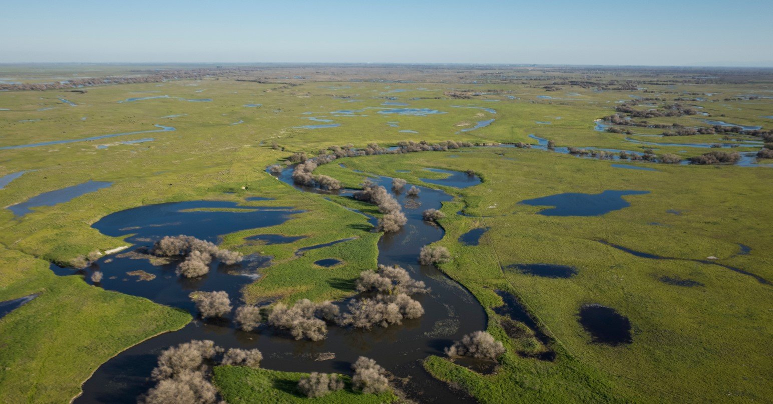
California’s Central Valley is a broad, fertile agricultural region stretching through the heart of the state between the Coast Ranges and the Sierra Nevada. Rather than being a single narrow valley, it is a vast lowland made up primarily of the Sacramento Valley in the north and the San Joaquin Valley in the south.
The region is important for agriculture, water management, wildlife, and California’s economic history. Its landscape includes productive farmland, major rivers, wetlands, orchards, vineyards, grasslands, and growing urban communities. Cities such as Sacramento, Fresno, Stockton, Modesto, and Bakersfield form important population and economic centers within or near the valley
| Fact | Details |
|---|---|
| Location | Central California, between the Coast Ranges and Sierra Nevada |
| Country | United States |
| Region | California |
| Main Divisions | Sacramento Valley and San Joaquin Valley |
| Elevation | Generally low-lying, with much of the valley near or below 500 feet |
| Famous For | Agriculture, orchards, vineyards, rivers and wetlands |
| Climate | Mediterranean, with hot dry summers and cool wetter winters |
| Main Rivers | Sacramento, San Joaquin, Feather and American |
| Best Months | March to May and October to November |
| Nearby Major Cities | Sacramento, Stockton, Fresno and Bakersfield |
Where Is Central Valley — California?
The Central Valley occupies a large portion of inland California. It extends for roughly 400 miles from the Sacramento area south toward the Tehachapi Mountains and is generally bordered by the Coast Ranges on the west and the Sierra Nevada on the east.
The northern section is known as the Sacramento Valley, while the southern portion is the San Joaquin Valley. Together, these two basins form the Central Valley. Major communities across the region include Sacramento, Stockton, Modesto, Merced, Fresno, Visalia, and Bakersfield.
Geography and Landscape
The Central Valley is a broad, relatively flat basin surrounded by mountain ranges. Its low elevation and extensive network of rivers have helped create exceptionally productive agricultural land.
The Sacramento River drains much of the northern valley, while the San Joaquin River serves the southern portion. Numerous tributaries, canals, reservoirs, wetlands, and floodplains form part of the region’s water system.
Much of the natural landscape has been transformed by agriculture and urban development. Orchards, vineyards, vegetable fields, rice paddies, and other cultivated areas dominate large sections. Remaining wetlands and riparian habitats are especially important for migratory birds and other wildlife.
The valley’s soils were built over thousands of years through sediment deposited by rivers flowing from the surrounding mountains. This combination of fertile sediment, relatively level terrain, and extensive water infrastructure helped establish California’s agricultural heartland.
History of Central Valley — California
Indigenous peoples have occupied the Central Valley for thousands of years. Numerous Native communities lived along its rivers, wetlands, grasslands, and oak landscapes, relying on fish, game, seeds, acorns, and other natural resources. The region’s Indigenous history is diverse, with communities including the Yokuts, Miwok, Maidu, Patwin, and other peoples.
Spanish and Mexican exploration brought new forms of settlement and land use to the wider region, while American migration increased significantly during the nineteenth century. The Gold Rush accelerated population growth in and around the Sacramento Valley and helped establish Sacramento as an important transportation and commercial center.
Agriculture expanded rapidly during the nineteenth and twentieth centuries. Irrigation transformed areas that had previously experienced seasonal flooding or limited water availability into highly productive farmland.
The development of dams, canals, reservoirs, railroads, highways, and agricultural industries further changed the region. Today, farming remains central to the Central Valley economy, while major cities and expanding communities have created a more diverse regional economy.
How Was Central Valley — California Formed?
The Central Valley is a large sediment-filled basin created through a combination of geological subsidence, mountain building, erosion, and sediment deposition. Over millions of years, sediments eroded from the surrounding mountains accumulated in the low-lying basin.
The Sacramento and San Joaquin river systems continue to transport sediment through the valley toward the Sacramento-San Joaquin Delta and ultimately San Francisco Bay. Geological processes and repeated changes in sea level have also influenced the basin’s development over time.
Central Valley — California Weather Throughout the Year
The Central Valley has a Mediterranean climate characterized by hot, dry summers and cooler, wetter winters. Weather varies from north to south, with Bakersfield and the southern San Joaquin Valley generally experiencing hotter conditions than the Sacramento area.
January to March
Winter is the wetter and cooler part of the year. Daytime temperatures are generally mild, while mornings and nights can be chilly. Rainfall is more common than during the rest of the year, although prolonged dry periods can still occur.
By March, temperatures begin rising and agricultural areas become increasingly green. Late winter and early spring can provide comfortable conditions for exploring cities, farms, wetlands, and outdoor attractions.
April to June
Spring brings warmer temperatures and increasingly dry conditions. April and May are often pleasant for outdoor activities, while June can become hot, particularly in the southern San Joaquin Valley.
Agricultural fields are active during this period, and the surrounding foothills can remain greener early in the season before summer dryness becomes dominant.
July to September
Summer is typically the hottest and driest period. Temperatures frequently rise well into the 90s°F (30s°C), with triple-digit heat possible in parts of the southern Central Valley.
Rain is scarce during summer, and prolonged hot weather is common. Visitors planning outdoor activities should generally choose cooler mornings or evenings.
October to December
Autumn begins with warm and dry conditions before temperatures gradually decline. October can remain quite warm, while November and December bring cooler days and an increasing possibility of rain.
The first significant seasonal storms generally occur during this period, although rainfall varies considerably from year to year.
Best Weather for Visiting Central Valley — California
March through May and October through November generally offer some of the most comfortable conditions for exploring the Central Valley. Spring is particularly suitable for outdoor sightseeing before the strongest summer heat arrives, while autumn brings cooler temperatures after the hottest part of the year.
Things to Do in Central Valley — California
- Explore agricultural communities: Visit farm regions, farmers markets, orchards, and vineyards that showcase the valley’s agricultural identity.
- Visit wetlands: Wildlife areas and restored wetlands provide opportunities for birdwatching and nature photography.
- Explore Sacramento: Discover museums, historic districts, riverfront areas, and cultural attractions in California’s capital.
- Enjoy cycling and outdoor recreation: Flat terrain in many parts of the valley makes cycling practical, while parks provide walking and recreation areas.
- Go birdwatching: The valley’s rivers, wetlands, and agricultural fields attract large numbers of resident and migratory birds.
- Visit local wineries: Wine-producing areas around Lodi and other parts of the Central Valley offer opportunities to explore California’s wine industry.
- Explore regional history: Museums, historic districts, missions, and agricultural heritage sites provide insight into the region’s development.
Famous Attractions in and Around Central Valley — California
California State Capitol
Located in Sacramento, the California State Capitol is an important political and architectural landmark and one of the region’s best-known historic buildings.
Old Sacramento
Old Sacramento preserves a historic waterfront district with nineteenth-century buildings, museums, shops, and reminders of the city’s role during the Gold Rush.
Sacramento-San Joaquin Delta
The Delta is a vast network of waterways where the Sacramento and San Joaquin river systems meet. It is notable for its waterways, agriculture, wetlands, and ecological importance.
Haggin Museum
Located in Stockton, the Haggin Museum contains art, historical collections, and exhibits focused on the development of the San Joaquin Valley.
Forestiere Underground Gardens
Near Fresno, this unusual attraction consists of hand-carved underground passages, courtyards, and gardens created by Sicilian immigrant Baldassare Forestiere.
Fresno Chaffee Zoo
The Fresno Chaffee Zoo provides a family-oriented wildlife attraction in the southern Central Valley and features animals and educational exhibits.
San Joaquin National Wildlife Refuge
Near Modesto, this protected area preserves wetlands, grasslands, and riparian habitat that are particularly important for birds and other wildlife.
Wildlife and Nature
Although much of the original Central Valley landscape has been converted to farmland, important natural habitats remain. Rivers, wetlands, grasslands, riparian forests, and protected wildlife areas provide refuge for numerous species.
The region is particularly significant for migratory birds traveling along the Pacific Flyway. Sandhill cranes, geese, ducks, herons, egrets, and other waterfowl can be found in suitable wetlands and agricultural areas during different seasons. Riparian habitats also support mammals such as river otters, beavers, coyotes, and other species.
Conservation programs focus on restoring wetlands, protecting river corridors, managing floodplains, and maintaining habitat for native and migratory wildlife.
How to Reach Central Valley — California
The Central Valley is well connected by major highways and rail lines. Interstate 5 runs through much of the western side, while State Route 99 serves as a major north-south route through the agricultural and urban centers of the valley.
Sacramento International Airport provides the main air gateway for the northern valley, while Fresno Yosemite International Airport serves the central and southern portions. Bakersfield also has regional air service.
Amtrak provides passenger rail connections through several Central Valley communities, including Sacramento, Stockton, Merced, Fresno, and Bakersfield. Bus services also connect major cities and surrounding communities.
Where to Stay Near Central Valley — California
Because the Central Valley covers such a large area, accommodation is best chosen according to the part of the region being explored. Sacramento offers the widest range of urban hotels and visitor services in the north, while Stockton, Modesto, Merced, Fresno, Visalia, and Bakersfield provide additional choices farther south.
Travelers interested in rural experiences can also find farm stays, guesthouses, wineries with accommodation, and campgrounds in selected areas. Larger cities are generally the most convenient bases for visitors combining sightseeing with road trips around the valley.
Why Is Central Valley — California Famous?
The Central Valley is famous for its extraordinary agricultural productivity, extensive river systems, broad flat landscapes, and importance to California’s food economy. Its combination of fertile soils, irrigation, major cities, wetlands, and surrounding mountain scenery gives the region a character distinct from California’s coastal and mountainous destinations.
Central Valley — California FAQs
Where is Central Valley — California located?
The Central Valley is in inland California, between the Coast Ranges and Sierra Nevada. It stretches from the Sacramento area south toward the Tehachapi Mountains.
What is Central Valley — California famous for?
It is best known for agriculture, orchards, vineyards, fertile soils, major rivers, wetlands, and cities such as Sacramento, Fresno, and Bakersfield.
What is the weather like in Central Valley — California?
The region generally has hot, dry summers and cooler, wetter winters. Southern areas tend to experience more intense summer heat.
What are the best months to visit Central Valley — California?
Spring and autumn generally offer the most comfortable temperatures, particularly March through May and October through November.
What can you do in Central Valley — California?
Visitors can explore cities, agricultural areas, museums, wetlands, wildlife refuges, wineries, historic sites, and outdoor recreation areas.
How do you reach Central Valley — California?
Interstate 5 and State Route 99 are major driving routes. The region is also served by airports, Amtrak trains, and intercity bus services.
Does Central Valley — California get snow?
Snow is uncommon across the valley floor. The surrounding Sierra Nevada receives substantial snowfall at higher elevations during winter.
Final Thoughts
Central Valley — California is more than an agricultural region. Its rivers, wetlands, productive farmland, historic communities, wildlife habitats, and major transportation corridors have played a central role in the development of inland California. For travelers interested in agriculture, nature, history, and California’s diverse inland landscapes, the valley offers a distinctive side of the state.
For More Visit Stay And Update
