
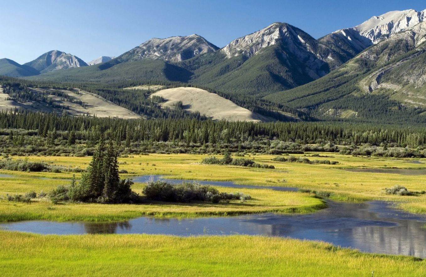
Athabasca Valley is a scenic mountain valley in the Canadian Rockies of Alberta, shaped by the Athabasca River and surrounded by rugged peaks, forests, lakes, and glacial landscapes. The valley forms an important natural corridor through Jasper National Park and is closely associated with the community of Jasper and the Icefields Parkway.
The valley combines dramatic Rocky Mountain scenery with a long human history. Indigenous peoples have traveled through the region for thousands of years, while later fur traders, explorers, railway builders, and travelers used the Athabasca Valley as an important route through the mountains.
Athabasca Valley Quick Facts
| Fact | Details |
|---|---|
| Location | Jasper National Park, Alberta, Canada |
| Country | Canada |
| Region | Canadian Rockies |
| Elevation | About 985 m (3,230 ft) in the lower valley |
| Main River | Athabasca River |
| Famous For | Rocky Mountain scenery, rivers, wildlife and transportation history |
| Climate | Continental mountain climate |
| Best Months | June to September for general sightseeing |
| Nearby Town | Jasper |
Where Is Athabasca Valley?
Athabasca Valley is located in west-central Alberta within Jasper National Park, on the eastern side of the Canadian Rockies. The valley follows the course of the Athabasca River and extends through a landscape of mountain ranges, forests, lakes, and adjoining valleys.
The town of Jasper sits on a plateau within the valley near the confluence of the Athabasca and Miette rivers. The valley also connects with major routes through the Rockies, including the Icefields Parkway and the historic Athabasca Pass corridor.
Geography and Landscape
The Athabasca Valley is a broad mountain valley dominated by the Athabasca River. Its lower elevations are surrounded by coniferous forests and mountain ranges, while higher terrain rises sharply toward alpine environments.
The river begins in the Columbia Icefield region and travels north through Jasper National Park. Along its route are dramatic geological features, mountain lakes, waterfalls, gravel terraces, and forests. The valley’s relatively low elevation compared with the surrounding mountains also creates a distinctive ecosystem within Jasper National Park.
Athabasca Falls is one of the most striking river features in the area. The river plunges through a narrow canyon where powerful water erosion has carved potholes and other formations into the underlying rock.
History of Athabasca Valley
Human history in the Athabasca Valley extends back at least 9,000 years. Indigenous peoples hunted, fished, gathered plants, traveled through the mountains, and used local stone resources long before European exploration. Their knowledge of mountain routes was also important to later travelers.
The fur trade transformed the valley into an important transportation corridor. Jasper House became a major stopping point for fur brigades traveling through the region and was strategically positioned near routes leading toward both Athabasca and Yellowhead passes.
Explorer David Thompson traveled through the region during the early nineteenth century, and Athabasca Pass became an important route between the interior of western Canada and the Pacific side of the mountains. Later, railway construction and the development of Jasper National Park brought new transportation links and tourism to the valley.
The community of Jasper developed as a railway settlement in the early twentieth century. Today, the valley remains an important gateway to Jasper National Park and the surrounding Rocky Mountain landscape.
How Was Athabasca Valley Formed?
The valley’s present landscape developed through a combination of geological uplift, erosion, and glaciation. The Rocky Mountains were uplifted over millions of years, while rivers gradually cut into the rising landscape.
During successive ice ages, glaciers moved through the Athabasca Valley, deepening and widening existing river valleys. The retreat of the glaciers left the broad mountain valley, terraces, exposed bedrock, and other glacial features visible today.
Athabasca Valley Weather Throughout the Year
Athabasca Valley has a continental mountain climate with cold winters, short summers, and rapidly changing conditions. Elevation, mountain orientation, winds, and proximity to glaciers all influence local weather.
January to March
Winter is cold, with snow covering much of the valley and surrounding mountains. January is typically the coldest month, with Jasper’s mean daily maximum around -9°C. Snow and freezing conditions can continue through March.
April to June
Spring arrives gradually. Valley snow begins to disappear during April, while higher elevations remain snowy much longer. Temperatures become increasingly mild through May and June, and rivers and waterfalls benefit from melting snow and ice.
July to September
Summer is the warmest period. July has a mean daily maximum of about 22.5°C in Jasper. Days can be pleasant for hiking and sightseeing, although mountain weather can change quickly. September brings cooler temperatures and the beginning of autumn colors.
October to December
Autumn becomes noticeably colder from October onward. September and October can offer clear skies and colorful vegetation, while November and December increasingly resemble winter, with snow and freezing temperatures becoming common.
Best Weather for Visiting Athabasca Valley
June through September generally provides the most comfortable conditions for hiking, sightseeing, photography, and road travel. July and August are the warmest months, while September and early October are appealing for cooler weather and autumn scenery.
Things to Do in Athabasca Valley
- Hiking: Trails around Jasper and the Athabasca River provide routes ranging from easy walks to more demanding mountain hikes.
- Scenic driving: The valley connects with some of the most scenic roads in the Canadian Rockies.
- Photography: Mountain peaks, rivers, waterfalls, forests, and changing seasonal light create excellent photographic opportunities.
- Wildlife watching: Visitors may encounter large mammals and birds along quieter roads and trails.
- Cycling: Roads and connector trails around Jasper provide opportunities to explore the valley by bicycle.
- Fishing: The Athabasca River and nearby lakes provide fishing opportunities where permitted under park regulations.
- Winter recreation: Snowshoeing, cross-country skiing, and other cold-weather activities are available in the wider Jasper area when conditions permit.
Famous Attractions in and Around Athabasca Valley
Athabasca Falls
A powerful 23-meter waterfall where the Athabasca River cuts through hard quartzite and creates a narrow canyon.
Jasper
The principal community in the valley provides visitor services, accommodation, restaurants, trails, and access to surrounding attractions.
Jasper House National Historic Site
The site preserves the location associated with an important fur-trade post that served travelers using mountain passes and the Athabasca River corridor.
Old Fort Point
A glacially shaped bedrock hill near Jasper that provides elevated views over the Athabasca Valley and surrounding mountains.
Athabasca Pass
A historic mountain route used extensively during the fur-trade era. The pass crosses the Continental Divide and connects Alberta with British Columbia.
Athabasca Glacier
Located farther south along the Icefields Parkway, the Athabasca Glacier is part of the Columbia Icefield and is one of the region’s most prominent glacial landmarks.
Sunwapta Falls
Located along the Icefields Parkway south of Jasper, these waterfalls are formed where the Sunwapta River drops through a rocky canyon.
Wildlife and Nature
Athabasca Valley supports a mixture of montane forests, river habitats, meadows, wetlands, and higher mountain ecosystems. The lower valley is relatively warm and dry compared with many higher parts of Jasper National Park, creating habitat for a variety of plants and animals.
Wildlife in the wider valley and Jasper region includes elk, mule deer, moose, bighorn sheep, mountain goats, black bears, grizzly bears, wolves, coyotes, and numerous bird species. Visitors should maintain safe distances from wildlife and never feed or approach animals.
How to Reach Athabasca Valley
The main gateway is the town of Jasper, which is accessible by road and rail. Highway 16, the Yellowhead Highway, passes through the area, while Highway 93, the Icefields Parkway, connects Jasper with Banff National Park to the south.
Edmonton International Airport is the nearest major international airport, while Calgary International Airport is another practical gateway for visitors approaching from the south. VIA Rail also serves Jasper, connecting the community with other Canadian destinations.
Winter conditions can affect roads, and mountain routes may experience snow, ice, or temporary restrictions. Travelers should check current road conditions before setting out.
Where to Stay Near Athabasca Valley
Jasper is the main accommodation base for exploring the Athabasca Valley. The town offers hotels, lodges, cabins, guesthouses, and other visitor accommodation.
Camping is also available at designated campgrounds in Jasper National Park. Travelers seeking a quieter setting can find accommodation in communities and properties outside Jasper, although staying farther away generally means longer driving times to attractions.
Why Is Athabasca Valley Famous?
Athabasca Valley is famous for its combination of Rocky Mountain scenery, the Athabasca River, wildlife, glacial landscapes, and historic transportation routes. Its position near Jasper also makes it an important gateway to some of Alberta’s most recognizable mountain attractions.
Athabasca Valley FAQs
Where is Athabasca Valley located?
Athabasca Valley is in Jasper National Park in west-central Alberta, Canada. The town of Jasper lies within the valley along the Athabasca River.
What is Athabasca Valley famous for?
It is known for the Athabasca River, Rocky Mountain scenery, wildlife, waterfalls, historic travel routes, and its connection with Jasper National Park.
What is the weather like in Athabasca Valley?
The valley has cold winters and short, warm summers. Weather can change quickly because of the surrounding mountains and elevation.
What are the best months to visit Athabasca Valley?
June through September generally offers the most convenient conditions for outdoor activities, while September and early October are particularly attractive for autumn scenery.
What can you do in Athabasca Valley?
Popular activities include hiking, photography, scenic driving, wildlife watching, cycling, fishing, and seasonal winter recreation.
How do you reach Athabasca Valley?
Jasper is the primary gateway. Highway 16 and the Icefields Parkway provide major road connections, while rail services connect Jasper with other Canadian cities.
Does Athabasca Valley get snow?
Yes. Snow is common during winter, and higher mountain areas can retain snow well into spring and receive snowfall even during summer weather systems.
Is Athabasca Valley near Jasper?
Yes. Jasper is located within the Athabasca Valley and serves as the principal community and visitor base for exploring the surrounding landscape.
Final Thoughts
Athabasca Valley combines the natural power of the Canadian Rockies with a history shaped by Indigenous travel, the fur trade, exploration, railways, and conservation. Its river, forests, mountain scenery, wildlife, and nearby attractions make it an important part of the Jasper region and a rewarding destination for visitors interested in both nature and history.
For More Visit Stay And Update
