
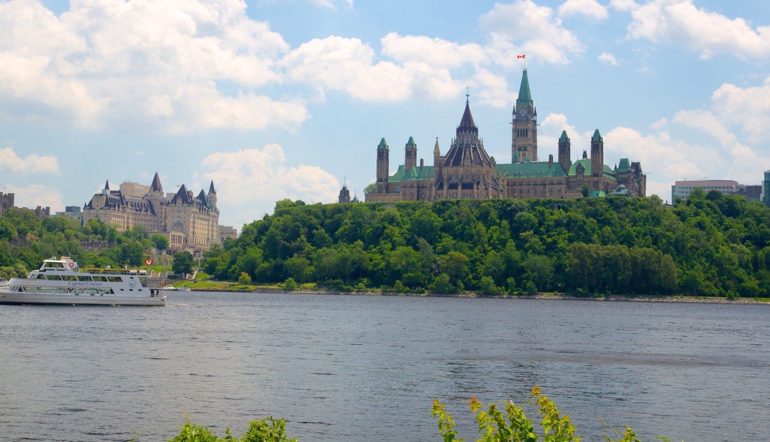
Ottawa Valley is a broad and scenic valley shaped by the Ottawa River along the border between Ontario and Quebec, Canada. Known for forests, rivers, lakes, small communities, and a long history connected to the timber trade, the region combines rugged Canadian landscapes with outdoor recreation and cultural heritage.
The valley is particularly appealing to visitors interested in hiking, paddling, fishing, camping, cycling, wildlife, and exploring rural communities. Its four-season climate also gives the area a distinct character throughout the year, from snowy winter landscapes to warm summers along the river and surrounding forests.
Ottawa Valley Quick Facts
| Fact | Details |
|---|---|
| Location | Eastern Ontario and western Quebec, along the Ottawa River |
| Country | Canada |
| Region | Ottawa River Valley |
| Main River | Ottawa River |
| Landscape | Forests, rivers, lakes, hills and Canadian Shield terrain |
| Famous For | Outdoor recreation, timber heritage and river landscapes |
| Climate | Humid continental |
| Best Months | Generally May to October |
| Major City Nearby | Ottawa |
| Major Communities | Pembroke, Renfrew, Arnprior and Deep River |
Where Is Ottawa Valley?
Ottawa Valley extends along the Ottawa River in eastern Ontario and western Quebec. The river forms much of the boundary between the two provinces, while the wider valley includes numerous towns, rural areas, lakes, forests, and smaller waterways.
The Ontario side includes communities such as Arnprior, Renfrew, Pembroke, Petawawa, and Deep River. On the Quebec side, communities including Gatineau, Pontiac, and several smaller municipalities form part of the broader Ottawa River landscape. Ottawa, Canada’s capital, lies at the eastern end of the valley and is the region’s principal urban center.
Geography and Landscape
The physical character of Ottawa Valley is closely connected to the Ottawa River and the Canadian Shield. The river flows through a landscape of forests, rocky terrain, wetlands, lakes, and rolling hills before joining the St. Lawrence River near Montreal.
The upper valley contains extensive Canadian Shield landscapes, where exposed bedrock and rugged terrain are common. Farther east, the landscape becomes more settled and agricultural in places, particularly around the Ottawa-Gatineau area.
The Ottawa River is the valley’s dominant geographical feature, but numerous tributaries and lakes add to the region’s complex network of waterways. The Laurentian Mountains rise north of the river in Quebec, while forested uplands characterize much of the Ontario side.
History of Ottawa Valley
The history of Ottawa Valley begins with Indigenous peoples who used the river and surrounding lands for travel, fishing, hunting, and trade. The Ottawa River served as an important transportation route long before European settlement, connecting communities across a large part of eastern Canada.
European exploration and the fur trade expanded during the seventeenth and eighteenth centuries. The river later became central to the region’s timber industry. During the nineteenth century, vast forests attracted lumber companies, and communities grew around logging, sawmills, river transportation, and related industries.
The timber trade played an especially important role in the development of towns such as Pembroke and Renfrew. Logs were floated downstream toward major markets, while canals, railways, and roads gradually transformed how goods and people moved through the region.
The construction of hydroelectric facilities also influenced the valley’s modern development. Today, communities across the region continue to preserve connections to logging, river transportation, Indigenous heritage, and rural Canadian life.
How Was Ottawa Valley Formed?
Ottawa Valley’s landscape reflects a combination of ancient bedrock, glacial activity, erosion, and river processes. The region’s Canadian Shield rocks are extremely old, and later geological changes created the broad river corridor visible today.
During the last Ice Age, glaciers covered much of the region. Moving ice eroded and reshaped the terrain while leaving deposits of sediment behind. As the glaciers retreated, meltwater helped establish and modify drainage patterns, including the Ottawa River system.
Ottawa Valley Weather Throughout the Year
Ottawa Valley has a humid continental climate, with warm summers, cold winters, and substantial seasonal variation. Conditions can differ between communities and elevations, but the four seasons are clearly defined.
January to March
Winter is cold, with regular snowfall and freezing temperatures. January and February are generally the coldest months. By March, temperatures begin to rise, although snow and icy conditions can remain common.
April to June
Spring brings rapidly changing conditions. April can still feel wintry, while May becomes milder and greener. June usually brings warmer temperatures, longer daylight hours, and increasingly favorable conditions for hiking, cycling, fishing, and paddling.
July to September
Summer is generally warm and relatively humid. July and August are the warmest months, making them popular for boating, camping, swimming, fishing, and other outdoor activities. September gradually becomes cooler and often brings the first noticeable signs of autumn.
October to December
Autumn is known for colorful foliage, particularly across the region’s extensive forests. October is generally comfortable for outdoor exploration, while November becomes cooler. By December, winter conditions typically return, with snow and freezing temperatures becoming increasingly common.
Best Weather for Visiting Ottawa Valley
May through October is generally the most comfortable period for exploring Ottawa Valley’s outdoor attractions. Summer is ideal for water-based recreation, while September and October are particularly appealing for hiking, scenic drives, and viewing autumn foliage.
Things to Do in Ottawa Valley
- Paddling: Canoeing and kayaking are popular along the Ottawa River and its connected waterways.
- Hiking: Trails through forests, hills, and conservation areas provide options for different experience levels.
- Fishing: The area’s rivers and lakes support recreational fishing for several freshwater species.
- Camping: Provincial parks, private campgrounds, and wilderness areas provide opportunities for overnight stays.
- Cycling: Rural roads and designated cycling routes offer ways to explore communities and countryside.
- Wildlife Watching: Forests, wetlands, and waterways provide opportunities to observe birds and mammals.
- Winter Recreation: Snowmobiling, cross-country skiing, snowshoeing, and other winter activities are popular during the colder months.
Famous Attractions in and Around Ottawa Valley
Ottawa River
The Ottawa River is the defining natural feature of the region and provides opportunities for boating, fishing, paddling, sightseeing, and river-based recreation.
Bonnechere Caves
Located near Eganville, Bonnechere Caves are a series of limestone caves containing geological formations created over long periods of erosion and deposition.
Bonnechere Provincial Park
Situated along Round Lake, this provincial park is known for its sandy beach, forests, camping facilities, and opportunities for swimming, boating, and hiking.
Driftwood Provincial Park
Located along the Ottawa River, Driftwood Provincial Park offers camping and access to the river within a forested setting.
Samuel de Champlain Provincial Park
This park near Mattawa features trails, camping, waterways, and landscapes associated with the historic Mattawa and Ottawa River corridor.
Canadian Nuclear Heritage Museum
Located in Deep River, the museum documents the history of nuclear research and development in the Ottawa Valley and the surrounding community.
Champlain Lookout
Near the Ottawa-Gatineau area, Champlain Lookout provides elevated views across the Ottawa Valley and surrounding Gatineau Hills.
Wildlife and Nature
Ottawa Valley’s forests, wetlands, rivers, and lakes support a diverse range of wildlife. White-tailed deer, black bears, beavers, river otters, foxes, and other mammals are found across the wider region. The waterways and wetlands also provide habitat for numerous bird species, including waterfowl and birds of prey.
The region’s forests contain mixtures of coniferous and deciduous trees, while wetlands and shoreline ecosystems are important for aquatic species and migratory birds. Provincial parks, conservation areas, and other protected lands help preserve these habitats while allowing controlled recreational use.
How to Reach Ottawa Valley
Ottawa is the principal transportation gateway to the eastern part of the valley and is served by Ottawa International Airport. From Ottawa, Highway 17 provides a major route into the Ontario portion of the region.
Highway 41 connects communities farther west, while Highway 60 provides access toward areas around Algonquin Provincial Park. On the Quebec side, roads from Gatineau and the Outaouais region provide access to communities along the northern side of the Ottawa River.
Driving is generally the most convenient way to explore the wider valley because attractions and communities are spread across a large geographic area. Winter travel can require additional preparation because of snow and icy road conditions.
Where to Stay Near Ottawa Valley
Accommodation is available throughout the region rather than being concentrated in one resort area. Pembroke, Renfrew, Arnprior, Petawawa, Deep River, and other communities offer hotels, motels, inns, and guesthouses.
Visitors looking for a nature-focused stay can choose from provincial park campgrounds, private campgrounds, cabins, and cottage rentals near lakes and rivers. Ottawa and Gatineau provide the widest range of conventional accommodation for travelers who prefer to stay in a larger urban center.
Why Is Ottawa Valley Famous?
Ottawa Valley is famous for its connection to the Ottawa River, extensive forests, timber heritage, Canadian Shield landscapes, and wide range of four-season outdoor activities. Its combination of waterways, rural communities, historic sites, and protected natural areas gives the region a distinctive character within eastern Canada.
Ottawa Valley FAQs
Where is Ottawa Valley located?
Ottawa Valley stretches along the Ottawa River across eastern Ontario and western Quebec, with Ottawa and Gatineau near its eastern end.
What is Ottawa Valley famous for?
The region is known for the Ottawa River, forests, outdoor recreation, logging heritage, lakes, and scenic rural landscapes.
What is the weather like in Ottawa Valley?
The valley experiences four distinct seasons, including cold snowy winters, mild springs, warm summers, and colorful autumns.
What are the best months to visit Ottawa Valley?
May through October generally offers the best conditions for outdoor activities, with July and August suited to water recreation and September and October popular for fall scenery.
What can you do in Ottawa Valley?
Visitors can hike, camp, fish, paddle, cycle, watch wildlife, explore caves, and enjoy a variety of winter sports.
How do you reach Ottawa Valley?
Ottawa provides the main air gateway, while highways connect the region’s communities. A car is generally the easiest way to explore the wider valley.
Does Ottawa Valley get snow?
Yes. Winter snowfall is a normal part of the region’s climate, and snow-based recreation is common during the colder months.
What attractions are near Ottawa Valley?
Notable places include Bonnechere Caves, Bonnechere Provincial Park, Driftwood Provincial Park, Samuel de Champlain Provincial Park, and attractions around Ottawa-Gatineau.
Final Thoughts
Ottawa Valley offers a distinctive blend of river landscapes, forests, communities, history, and outdoor recreation. Its changing seasons make it suitable for different experiences throughout the year, whether visitors are interested in paddling and camping in summer, colorful forests in autumn, or snow-based activities in winter.
For More Visit Stay And Update
