
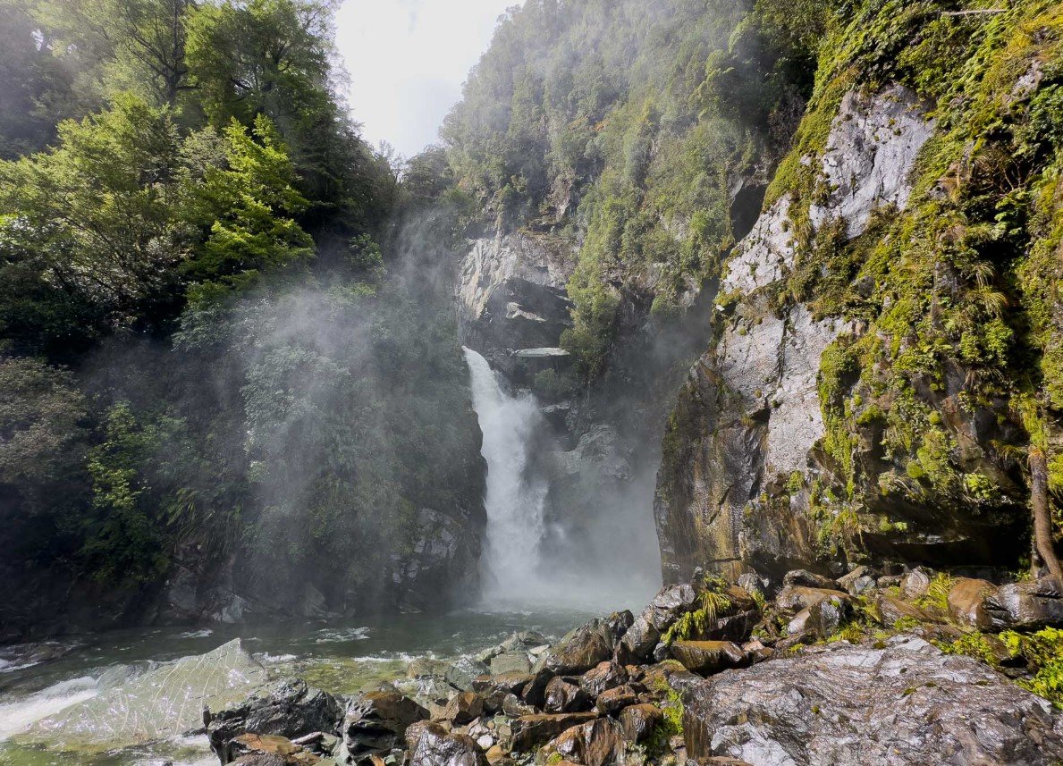
Hollyford Valley is a remote, forested valley in Fiordland National Park on New Zealand’s South Island. Stretching from the rugged mountains of Fiordland toward the West Coast, the valley follows the Hollyford River/Whakatipu Kā Tuka through a landscape of native forest, lakes, wetlands and dramatic mountain scenery.
The valley is best known for the Hollyford Track, a multi-day journey connecting the mountains with the coast at Martins Bay. Its combination of lowland rainforest, glacial landscapes, waterways and coastal environments makes Hollyford Valley an important natural and recreational area within Fiordland.
Hollyford Valley Quick Facts
| Fact | Details |
|---|---|
| Location | Fiordland National Park, South Island, New Zealand |
| Country | New Zealand |
| Region | Fiordland, Southland |
| Elevation | Low-elevation valley; surrounding mountains rise to over 2,700 m |
| Famous For | Hollyford River, forests, lakes and Hollyford Track |
| Climate | Cool, wet and temperate |
| Main River | Hollyford River/Whakatipu Kā Tuka |
| Best Months | Generally November to April for milder conditions |
| Nearest Town | Te Anau |
Where Is Hollyford Valley?
Hollyford Valley lies in the northern part of Fiordland National Park in southwestern New Zealand’s South Island. It extends from the Darran Mountains toward the Tasman Sea, with the Hollyford River forming the valley’s main drainage route.
The nearest town with substantial visitor facilities is Te Anau. The valley is reached from the Milford Road, or State Highway 94, with the Hollyford Road branching off at Marian Corner near The Divide. The remote character of the area means that services become increasingly limited farther into the valley.
Geography and Landscape
Hollyford Valley is surrounded by some of Fiordland’s most rugged mountain country. The Darran Mountains dominate its eastern end, while the valley gradually transitions through dense native forest, lakes and wetlands toward the coast.
The Hollyford River runs through the valley before reaching Lake McKerrow/Whakatipu Waitai and eventually Martins Bay. Lake Alabaster/Wāwāhi Waka is another major water feature along the route. Mount Tūtoko, at 2,723 metres, is among the prominent high peaks associated with the surrounding landscape.
Native beech forest covers much of the lower valley, mixed with podocarp trees and dense vegetation. Ferns, mosses and lichens thrive in the consistently moist environment, giving the valley its characteristic lush appearance.
History of Hollyford Valley
Māori had long-standing connections with Fiordland, using routes through the region for seasonal travel, food gathering and access to pounamu, or greenstone. Martins Bay, known traditionally as Kotuku, was an important settlement area, with access to resources from the sea, forests and nearby lakes.
European exploration increased during the nineteenth century. Whalers, surveyors and explorers entered the region, while reports of timber and mineral resources encouraged further interest. The valley’s isolation, however, made permanent settlement difficult.
Settlers attempted to establish communities around Martins Bay and Jamestown. Farming was also undertaken in parts of the valley, but transporting livestock and supplies across the rugged country presented major challenges. The area later became increasingly associated with wilderness travel and tourism.
Today, the valley forms part of Fiordland National Park, which was officially established in 1952. The wider Fiordland region is protected for its exceptional landscapes, ecosystems and cultural heritage.
How Was Hollyford Valley Formed?
The valley has a strongly glacial origin. During the last ice age, a massive glacier moved through the region, carving the characteristic broad, U-shaped Hollyford Valley into the underlying rock.
Glacial erosion also helped shape the surrounding mountains and basins. Lake McKerrow was originally a fiord connected to the sea before sediment accumulated around Martins Bay and separated it from the open coast. Rivers, landslides and ongoing erosion continue to modify the landscape.
Hollyford Valley Weather Throughout the Year
Hollyford Valley has a cool, wet climate typical of western Fiordland. Rain can occur at any time of year, and weather can change rapidly. Conditions are often considerably wetter than those experienced in eastern parts of the South Island.
January to March
Summer generally brings the mildest temperatures, although rain remains common. Days can be suitable for hiking and other outdoor activities, but visitors should still expect wet conditions and carry appropriate rain protection.
April to June
Autumn becomes cooler and increasingly unsettled. Rainfall remains substantial, while shorter daylight hours and changing mountain conditions become more important considerations for walkers.
July to September
Winter is cold and wet, particularly in the surrounding mountains. Snow and ice are more common at higher elevations, although the Hollyford Track remains a relatively low-altitude route compared with many other Fiordland tracks.
October to December
Spring brings gradually warmer conditions, longer daylight and renewed growth in the forest. Rain remains frequent, and heavy weather can affect tracks, streams and roads.
Best Weather for Visiting Hollyford Valley
Late spring through early autumn, particularly November to April, generally offers the most comfortable combination of longer daylight and milder temperatures. However, Hollyford Valley can be wet in every season, so weather preparedness is essential.
Things to Do in Hollyford Valley
- Hike the Hollyford Track: The valley’s signature activity is the multi-day Hollyford Track, which follows the river from the mountains toward Martins Bay.
- Take shorter walks: Routes such as Hidden Falls and Humboldt Falls provide shorter ways to experience the valley.
- Wildlife watching: Forests, wetlands, lakes and coastal habitats provide opportunities to observe native birds and other wildlife.
- Fishing: Fishing is available in appropriate waterways, subject to local regulations and seasonal requirements.
- Kayaking: The valley’s lakes and waterways provide opportunities for experienced paddlers where conditions and access permit.
- Climbing: The surrounding Darran Mountains are an important destination for experienced climbers.
- Photography: Mountain views, waterfalls, forests, lakes and the remote coastline offer varied landscape photography opportunities.
Famous Attractions in and Around Hollyford Valley
Hollyford Track
The Hollyford Track is a 56-kilometre journey from the Lower Hollyford Road toward Martins Bay. It is one of the valley’s defining features and can be walked throughout the year, subject to conditions.
Lake McKerrow/Whakatipu Waitai
This long lake occupies part of the lower Hollyford system and is surrounded by forested mountains. It was once connected to the sea as a fiord.
Lake Alabaster/Wāwāhi Waka
Lake Alabaster is a remote glacial lake surrounded by forest and mountains. It forms an important section of the Hollyford Track.
Humboldt Falls
Humboldt Falls is reached by a short walk from the Hollyford Road and provides a relatively accessible introduction to the area’s rainforest and waterfall scenery.
Martins Bay
At the western end of the valley, Martins Bay marks the transition from the river environment to the Tasman Sea. The surrounding coast supports wildlife and provides views across the remote shoreline.
Jamestown
The former settlement of Jamestown lies beside Lake McKerrow. Remnants of introduced plants provide evidence of the area’s early European settlement.
Mount Tūtoko
Rising to 2,723 metres, Mount Tūtoko is one of the major peaks visible from the broader Hollyford region and an important feature of the surrounding Darran Mountains.
Wildlife and Nature
Hollyford Valley supports a rich mixture of forest, wetland, river and coastal ecosystems. Native birds recorded in the area include kākā, kea, mohua, kererū, New Zealand falcon, tomtit, bellbird, fantail and rifleman. Fernbirds and bitterns can occur in wetland habitats.
The valley also supports native fish and the rare short-tailed bat. Fur seals and Fiordland crested penguins can be encountered around the coastal portion of the valley, while dolphins occasionally enter Lake McKerrow through the river mouth. The extensive native forest and surrounding protected land are important parts of Fiordland’s conservation network.
How to Reach Hollyford Valley
The main road approach begins on State Highway 94, the Milford Road, between Te Anau and Milford Sound. The turnoff for Hollyford Road is at Marian Corner, shortly after The Divide when traveling toward Milford Sound.
From Te Anau, the journey to the end of Hollyford Road takes around two hours under normal conditions. The road beyond the main highway is unsealed, and weather can affect access. Visitors undertaking the Hollyford Track can also arrange transport services for different sections of the journey.
Where to Stay Near Hollyford Valley
Accommodation is limited because of the valley’s remote character. Te Anau is the nearest major service town and provides the widest choice of hotels, lodges, guesthouses and other accommodation.
Within the valley, the Hollyford Track has backcountry huts for multi-day walkers. Camping is also possible at designated locations subject to current park regulations. Some guided experiences provide accommodation or transport arrangements as part of their packages.
Why Is Hollyford Valley Famous?
Hollyford Valley is famous for its remote journey from the mountains of Fiordland to the Tasman Sea, its glacially carved landscape, dense native forests, major lakes and the Hollyford Track. Its combination of mountain, river, forest and coastal environments makes it a distinctive part of New Zealand’s Fiordland region.
Hollyford Valley FAQs
Where is Hollyford Valley located?
Hollyford Valley is in Fiordland National Park on New Zealand’s South Island. It lies north of Te Anau and extends toward Martins Bay on the West Coast.
What is Hollyford Valley famous for?
It is best known for the Hollyford River, Hollyford Track, dramatic Fiordland mountains, native forest, lakes and remote coastal scenery.
What is the weather like in Hollyford Valley?
The valley has a cool and very wet climate, with rainfall possible throughout the year. Mountain weather can change quickly.
What are the best months to visit Hollyford Valley?
November through April generally offers milder temperatures and longer daylight, although wet weather remains possible.
What can you do in Hollyford Valley?
Popular activities include multi-day hiking, shorter walks, fishing, wildlife watching, photography, kayaking and climbing.
How do you reach Hollyford Valley?
The valley is accessed from State Highway 94 via Hollyford Road at Marian Corner. Te Anau is the nearest town with major visitor facilities.
Does Hollyford Valley get snow?
Snow is possible, particularly in the surrounding mountains during winter. The valley floor is at a relatively low elevation compared with the surrounding alpine terrain.
Is Hollyford Valley suitable for hiking?
Yes. The Hollyford Track is a major multi-day route, while shorter walks such as Hidden Falls provide options for visitors who do not want to complete the full track.
Final Thoughts
Hollyford Valley offers a distinctive combination of glacial mountain scenery, native rainforest, rivers, lakes and remote coastal landscapes. Its wilderness character and the famous Hollyford Track make it particularly appealing to visitors interested in hiking, nature, wildlife and exploring one of New Zealand’s less-developed valleys.
For More Visit Stay And Update
