
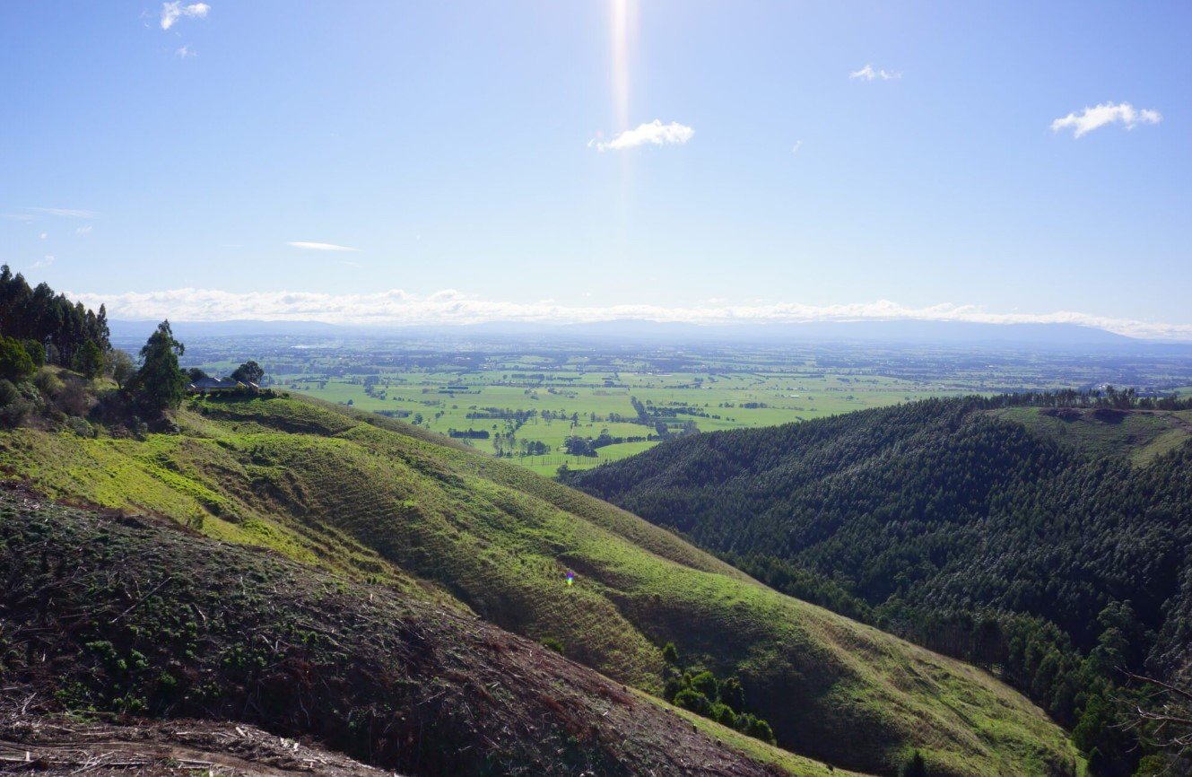
Latrobe Valley is a broad inland valley in Gippsland, Victoria, Australia, known for its long connection with coal mining, electricity generation, agriculture, and regional industry. The valley stretches across a landscape of farmland, forests, waterways, and established towns, with Traralgon, Morwell, Moe, and nearby communities forming its main population centres.
Although its industrial history is an important part of its identity, the area also provides access to lakes, parks, walking trails, forests, gardens, and the wider Gippsland region. Its location between Melbourne and eastern Gippsland makes the valley a useful base for exploring both rural Victoria and nearby natural attractions.
Latrobe Valley Quick Facts
| Fact | Details |
|---|---|
| Location | Gippsland, southeastern Victoria |
| Country | Australia |
| Region | Gippsland |
| Elevation | Generally low-lying valley terrain |
| Main Towns | Traralgon, Morwell, Moe |
| Famous For | Brown coal, electricity generation, industry and Gippsland landscapes |
| Climate | Temperate, with warm summers and cool winters |
| Best Months | October to April |
| Nearby Major City | Melbourne |
Where Is Latrobe Valley?
Latrobe Valley is located in southeastern Victoria, within the Gippsland region of Australia. It lies approximately 150 kilometres east of Melbourne and extends through a corridor that includes Moe, Morwell and Traralgon.
The valley sits between the Great Dividing Range to the north and the Strzelecki Ranges to the south. Its position gives it a transition between agricultural lowlands and the forested hills and mountains of central and eastern Gippsland.
Geography and Landscape
The landscape is characterized by relatively low, fertile valley floors surrounded by rolling hills and forested ranges. The Latrobe River and its tributaries form an important part of the area’s drainage system, while several reservoirs and lakes are associated with the region’s water and industrial infrastructure.
One of the valley’s most significant physical resources is its extensive brown-coal deposit. The coal occurs relatively close to the surface, which historically made open-cut mining practical on a large scale.
Beyond the developed areas, the landscape becomes increasingly rural and forested. Nearby places such as the Tyers Gorge and the foothills toward Mount Baw Baw provide a marked contrast to the industrial areas around Morwell and Yallourn.
History of Latrobe Valley
The history of Latrobe Valley begins with the Gunaikurnai people, the Traditional Owners of much of Gippsland. Their connection with the land predates European settlement by thousands of years, and the valley forms part of a wider cultural landscape extending across Gippsland.
European pastoral settlement expanded across Gippsland during the nineteenth century. Towns and transport links developed as farming, timber production, and other industries grew. Coal deposits were identified as an important regional resource, eventually changing the economic direction of the valley.
Large-scale brown-coal mining and electricity generation became central to the local economy during the twentieth century. Yallourn developed into a major industrial centre, while Morwell became strongly associated with the Hazelwood power and mining complex. Electricity generated from locally mined coal supplied much of Victoria for decades.
The energy industry has since entered a major transition. Hazelwood Power Station closed in 2017, and the region has increasingly focused on economic diversification, renewable energy, new industries, tourism, and rehabilitation of former mining areas.
How Was Latrobe Valley Formed?
Latrobe Valley is part of a geological basin formed through long-term subsidence and sediment accumulation. Over geological time, vegetation and organic material accumulated in swampy environments and were buried beneath layers of sediment.
Pressure and heat gradually transformed this organic material into brown coal. The extensive coal seams beneath the valley later became one of its defining economic resources. Erosion and river processes subsequently shaped the surrounding surface landscape.
Latrobe Valley Weather Throughout the Year
Latrobe Valley has a temperate climate, with warm summers, cool winters, and rainfall distributed throughout the year. Conditions can vary between the valley floor and surrounding elevated areas.
January to March
Summer is generally warm and comparatively dry. Daytime temperatures commonly reach the mid-20s °C, although hotter periods can occur. Late summer gradually becomes cooler as autumn approaches.
April to June
Autumn brings cooler days and more noticeable overnight chill. Rainfall remains possible throughout the season, while temperatures generally decline toward winter. By June, mornings can be cold, particularly in rural and elevated areas.
July to September
Winter is cool, with frequent cloudy or wet conditions and cold nights. Frost can occur in inland parts of the valley. September marks the transition toward spring, with gradually increasing daylight and temperatures.
October to December
Spring brings milder conditions and increasingly warm days. October and November are generally comfortable for outdoor activities, while December begins the transition into summer.
Best Weather for Visiting Latrobe Valley
October through April is generally the most comfortable period for exploring the valley, particularly for walking, sightseeing, gardens, lakes, and nearby outdoor attractions. Spring offers mild temperatures and fresh vegetation, while summer provides longer daylight hours for exploring the surrounding region.
Things to Do in Latrobe Valley
Explore Local Walking Trails
The valley and surrounding countryside contain walking and cycling routes through parks, reserves, forests, and former industrial landscapes.
Visit Lake Narracan
Lake Narracan provides opportunities for boating, fishing, paddling, picnicking, and relaxing beside the water. It is one of the area’s popular recreation destinations.
Discover Local Gardens and Parks
Moe Botanic Gardens and the Morwell Centenary Rose Garden provide accessible green spaces for visitors interested in plants, landscaped gardens, and relaxed walks.
Explore Gippsland Forests
The surrounding region provides access to forested landscapes and longer outdoor adventures, particularly toward Tyers, Erica, Rawson, and the Baw Baw area.
Experience Regional Food and Wine
Traralgon and surrounding Gippsland communities offer cafés, restaurants, local produce, wineries, and farm-based experiences.
Follow Local Heritage Trails
The valley’s industrial and railway history can be explored through heritage sites, former mining communities, railway corridors, and local museums.
Famous Attractions in and Around Latrobe Valley
Lake Narracan
Located near Moe, Lake Narracan is a large recreational lake popular for boating, fishing, waterskiing, canoeing, and family outings.
Morwell National Park
This protected area is known for its forested environment and stands of remnant vegetation, providing a natural contrast to the heavily developed parts of the valley.
Morwell Centenary Rose Garden
One of Morwell’s best-known public gardens, the rose garden features extensive landscaped areas and seasonal displays.
Moe Botanic Gardens
These gardens provide a peaceful green space near the centre of Moe and are connected with walking routes through the town.
Tyers Park
Tyers Park, including the area around Petersons Lookout, provides views into the Tyers Gorge and access to bushwalking opportunities.
Walhalla
The historic gold-mining settlement of Walhalla lies beyond the eastern side of the valley and is one of Gippsland’s best-known heritage destinations.
Traralgon Railway Reservoir Conservation Reserve
This reserve combines walking trails, wetlands, woodland, and bird habitat close to Traralgon.
Yallourn North and Former Yallourn Area
The communities around Yallourn provide an opportunity to understand the area’s long relationship with coal mining, power generation, and industrial development.
Wildlife and Nature
Latrobe Valley contains a mixture of agricultural land, wetlands, waterways, grasslands, woodland, and forest. The surrounding Gippsland forests support a broad range of native Australian wildlife, while lakes and wetlands provide habitat for waterbirds.
Commonly encountered wildlife in the wider region includes kangaroos, wallabies, wombats, possums, echidnas, and many native bird species. Forested areas toward Tyers and the Baw Baw ranges support richer habitats than the more developed valley floor.
Conservation areas such as Morwell National Park are particularly important because they protect remaining native vegetation within a landscape that has experienced extensive agricultural and industrial development.
How to Reach Latrobe Valley
The main road connection is the Princes Highway, which passes through the valley and links Melbourne with eastern Gippsland. Traralgon, Morwell, and Moe are connected by the Gippsland railway line, providing regular rail access from Melbourne.
The nearest major airport is Melbourne Airport, approximately two hours away by road depending on the destination within the valley and traffic conditions. Regional bus and coach services also connect the main towns with surrounding Gippsland communities.
A car is useful for reaching smaller settlements, reserves, lakes, and attractions outside the main urban centres.
Where to Stay Near Latrobe Valley
Accommodation is concentrated in the larger towns, particularly Traralgon, Morwell, and Moe. Visitors can choose from hotels, motels, serviced accommodation, holiday parks, guesthouses, and other short-stay options.
Traralgon is a convenient base for visitors wanting a wider choice of restaurants, shops, and services. Morwell is useful for exploring the central valley, while smaller communities and rural areas provide options for travelers looking for a quieter setting.
Why Is Latrobe Valley Famous?
Latrobe Valley is best known for its extensive brown-coal resources and its historic role in Victoria’s electricity industry. Its identity, however, extends beyond mining and power generation to include Gunaikurnai heritage, farming communities, regional towns, lakes, forests, parks, and access to the wider Gippsland landscape.
Latrobe Valley FAQs
Where is Latrobe Valley located?
Latrobe Valley is in Gippsland, southeastern Victoria, Australia, approximately 150 kilometres east of Melbourne. Its main towns include Moe, Morwell, and Traralgon.
What is Latrobe Valley famous for?
It is particularly famous for its brown-coal deposits, electricity generation, mining history, and industrial heritage.
What is the weather like in Latrobe Valley?
The valley has a temperate climate with warm summers, cool winters, and rainfall throughout the year. Winter is generally the coolest and wetter period.
What are the best months to visit Latrobe Valley?
October through April generally provides comfortable conditions for sightseeing and outdoor activities, with spring and autumn offering especially mild weather.
What can you do in Latrobe Valley?
Visitors can explore gardens, lakes, walking trails, reserves, heritage sites, local towns, and surrounding forests. Lake Narracan is particularly suited to water-based recreation.
How do you reach Latrobe Valley?
The Princes Highway provides the main road connection, while the Gippsland railway line connects Moe, Morwell, and Traralgon with Melbourne.
Does Latrobe Valley get snow?
Snow is uncommon across the valley floor. However, snow can occur more frequently at higher elevations in the nearby Baw Baw and Great Dividing Range areas.
Final Thoughts
Latrobe Valley offers a distinctive combination of industrial heritage, regional communities, agricultural landscapes, waterways, forests, and natural attractions. Its history is closely tied to Victoria’s energy industry, while its surrounding parks, lakes, and Gippsland countryside provide plenty of opportunities for visitors interested in nature, recreation, and regional history.
For More Visit Stay And Update
