
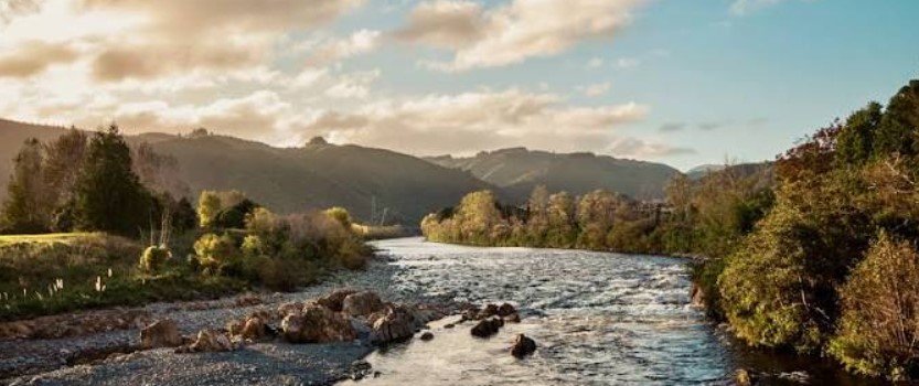
Hutt Valley is a broad river valley in the Wellington Region of New Zealand’s North Island, extending from Wellington Harbour through Lower Hutt and Upper Hutt toward the northern ranges. The valley combines urban communities with riverside trails, native bush, regional parks, farmland, and access to the surrounding mountains.
The valley’s identity is closely linked to Te Awa Kairangi / Hutt River, which runs through its centre before reaching Wellington Harbour. Its position between steep hills and major waterways has shaped settlement, transportation, agriculture, industry, recreation, and the area’s long history.
Hutt Valley Quick Facts
| Fact | Details |
|---|---|
| Location | Wellington Region, North Island, New Zealand |
| Country | New Zealand |
| Region | Greater Wellington |
| Main River | Te Awa Kairangi / Hutt River |
| Elevation | Low-lying river floodplains rising into surrounding hills |
| Famous For | Hutt River, parks, trails, bush and proximity to Wellington |
| Climate | Temperate, maritime |
| Best Months | Generally December to March |
| Main Cities | Lower Hutt and Upper Hutt |
| Nearby Major City | Wellington |
Where Is Hutt Valley?
Hutt Valley is immediately northeast of Wellington city and Wellington Harbour. It follows the course of Te Awa Kairangi / Hutt River and includes the two main urban areas of Lower Hutt in the southern valley and Upper Hutt farther north.
The valley connects the harbour with the inland Wairarapa region through routes across the Remutaka Range. Its position makes it both a residential area for people working in Wellington and an important gateway to the wider countryside of the Wellington Region.
Geography and Landscape
The valley consists largely of broad river plains bordered by steep hills and mountain ranges. The Hutt River is its central geographical feature, flowing from the southern Tararua Range toward Wellington Harbour.
A notable feature is the contrast between the relatively flat valley floor and the surrounding forested hills. Taitā Gorge separates the lower and upper sections, while the Remutaka and Akatarawa ranges form important parts of the surrounding landscape.
The valley also contains a mixture of developed urban areas, parks, waterways, farmland, native bush, and coastal environments. Its lower end opens toward Wellington Harbour, while the upper valley becomes increasingly rural and mountainous.
History of Hutt Valley
Hutt Valley has a long Māori history. Te Awa Kairangi was an important travel and food-gathering route, and Māori communities occupied and used areas throughout the valley before European settlement. The river has carried several Māori names over time, with Te Awa Kairangi being the name commonly used today.
European settlement began in the nineteenth century. The New Zealand Company initially planned a settlement at Petone, near the mouth of the Hutt River, but flooding and the physical conditions of the lower valley contributed to the decision to develop Wellington as the principal settlement.
Flooding remained a major challenge during the early settlement period. The 1855 Wairarapa earthquake significantly altered the valley and river, while later floods encouraged the development of river-control works and stopbanks.
The arrival of the railway in the nineteenth century improved connections between the valley, Wellington, and the Wairarapa. Agriculture, manufacturing, housing, and commerce subsequently expanded, eventually producing the modern Lower Hutt and Upper Hutt urban areas.
How Was Hutt Valley Formed?
Hutt Valley developed around the Hutt River and its floodplains, with the landscape strongly influenced by tectonic activity along the Wellington Fault. The river follows a geological structure associated with the active fault system, while erosion and sediment deposition have helped create the flatter areas occupied by settlements.
Earthquakes and flooding have repeatedly altered the valley. The 1855 earthquake raised parts of the valley floor and changed the Hutt River, while subsequent river flooding deposited and moved sediment across the floodplain.
Hutt Valley Weather Throughout the Year
Hutt Valley has a temperate maritime climate influenced by Wellington Harbour and the surrounding hills. Conditions can vary between Lower and Upper Hutt, with the upper valley generally experiencing greater temperature variation.
January to March
Summer is usually the warmest period, with generally mild to warm days and cooler evenings. December through February are commonly among the more settled months, although rain can occur at any time.
April to June
Autumn gradually brings cooler temperatures and increasing rainfall. Days remain relatively mild during April, while May and June become cooler and wetter as winter approaches.
July to September
Winter is cool and often unsettled, with regular rainfall and occasional strong winds. Upper Hutt can experience colder overnight conditions and frost more readily than the lower valley.
October to December
Spring brings gradually warmer temperatures, longer daylight hours, and changeable weather. Rain remains possible, but conditions generally become more suitable for outdoor activities as summer approaches.
Best Weather for Visiting Hutt Valley
December through March generally offers the warmest conditions for walking, cycling, exploring regional parks, and enjoying the river and coastal areas. Autumn and spring can also be pleasant for outdoor visits, while travelers should be prepared for changeable weather throughout the year.
Things to Do in Hutt Valley
- Walk or cycle the Hutt River Trail: The riverside route provides an accessible way to explore the valley on foot or by bicycle.
- Explore regional parks: Belmont, East Harbour, and Remutaka regional parks offer walking tracks and outdoor recreation.
- Visit the coast: Petone, Eastbourne, and Days Bay provide opportunities to combine valley sightseeing with waterfront experiences.
- Hike through native bush: Numerous tracks lead through forested hills and reserves surrounding the urban areas.
- Go fishing: The Hutt River provides opportunities for recreational fishing in suitable locations.
- Try outdoor cycling: The valley connects with the Remutaka Cycle Trail and other cycling routes.
- Explore local culture: Museums, galleries, markets, cafés, and heritage areas provide alternatives to outdoor activities.
Famous Attractions in and Around Hutt Valley
Hutt River Trail
This 18-kilometre riverside route follows Te Awa Kairangi through much of the valley and is one of the area’s best-known recreational corridors.
Kaitoke Regional Park
Located north of Upper Hutt, Kaitoke combines native forest, rivers, picnic areas, and walking tracks in a scenic natural setting.
Remutaka Cycle Trail
This Great Ride connects the Wellington Region with the Wairarapa and passes through varied landscapes around the Hutt Valley and Remutaka Range.
The Dowse Art Museum
Located in Lower Hutt, The Dowse presents contemporary art and design exhibitions and is one of the region’s major cultural institutions.
Petone
Petone is a historic waterfront area at the southern end of the valley, known for its heritage, shops, restaurants, and connection with Wellington Harbour.
Days Bay
Days Bay is a popular coastal destination near Eastbourne, offering waterfront scenery, walking opportunities, and views across Wellington Harbour.
Belmont Regional Park
The park covers extensive hill country between Lower and Upper Hutt and contains walking and cycling tracks with views across the surrounding region.
Wildlife and Nature
The valley’s natural environment ranges from river ecosystems and wetlands to native forest and coastal habitats. Surrounding regional parks protect substantial areas of bush, while the Hutt River provides an important freshwater corridor.
Native birds are common in the region, and surrounding forests provide habitat for species including tūī, kererū, fantails, and other New Zealand birdlife. Conservation projects across the wider Hutt Valley focus on restoring native vegetation, improving waterways, and protecting wildlife habitats.
How to Reach Hutt Valley
Hutt Valley is easily accessible from Wellington by road and public transport. State Highway 2 is the principal road connection through the valley, continuing north toward the Wairarapa.
The Hutt Valley Line provides frequent rail connections between Wellington, Lower Hutt, and Upper Hutt, making train travel a practical option for visitors. Local bus services connect the valley’s towns and suburbs, while Wellington International Airport is the nearest major airport.
Where to Stay Near Hutt Valley
Accommodation is available throughout Lower Hutt and Upper Hutt, with options including hotels, motels, guesthouses, holiday accommodation, and campsites. Petone and Eastbourne provide choices closer to the harbour, while Upper Hutt offers convenient access to regional parks and the northern valley.
Travelers looking for a wider range of accommodation can also stay in Wellington and visit the valley by train or road.
Why Is Hutt Valley Famous?
Hutt Valley is known for its combination of river landscapes, two established cities, surrounding native bush, regional parks, coastal communities, and close connection to Wellington. Its position along Te Awa Kairangi makes it both an important urban corridor and a gateway to the outdoor landscapes of the Wellington Region.
Hutt Valley FAQs
Where is Hutt Valley located?
Hutt Valley is in the Wellington Region of New Zealand’s North Island, immediately northeast of Wellington and extending inland from Wellington Harbour.
What is Hutt Valley famous for?
It is known for Te Awa Kairangi / Hutt River, Lower Hutt and Upper Hutt, regional parks, walking and cycling trails, and its proximity to Wellington.
What is the weather like in Hutt Valley?
The valley has a temperate maritime climate with mild summers, cool winters, regular rainfall, and changeable conditions throughout the year.
What are the best months to visit Hutt Valley?
December through March generally provides the warmest conditions for outdoor activities, although the valley can be visited throughout the year.
What can you do in Hutt Valley?
Popular activities include hiking, cycling, walking beside the river, exploring regional parks, visiting museums, enjoying coastal areas, and fishing.
How do you reach Hutt Valley?
The valley is connected to Wellington by State Highway 2, rail services, and local buses. Wellington International Airport is the nearest major airport.
Does Hutt Valley get snow?
Snow is uncommon on the valley floor, although colder conditions and occasional snow can occur at higher elevations in the surrounding ranges.
What attractions are near Hutt Valley?
Notable places include Kaitoke Regional Park, the Hutt River Trail, Remutaka Cycle Trail, Petone, Days Bay, Belmont Regional Park, and The Dowse Art Museum.
Final Thoughts
Hutt Valley offers a distinctive combination of river plains, forested hills, coastal scenery, urban communities, and easy access to the wider Wellington landscape. Its mix of outdoor recreation, history, culture, and convenient transport makes it an interesting valley to explore or use as a base for discovering the region.
For More Visit Stay And Update
