
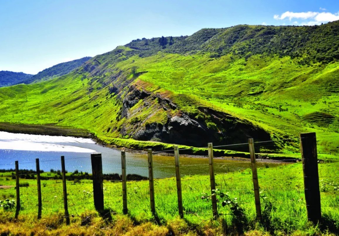
Waipoua Valley is a forested valley on the west coast of Northland, New Zealand, best known for its ancient kauri forest and deep connection with Māori culture. The landscape is dominated by native vegetation, streams, rolling terrain, and some of the country’s most remarkable surviving kauri trees.
The valley forms part of the wider Waipoua forest landscape, one of the largest remaining areas of native forest in Northland. Its combination of ancient trees, wildlife, cultural heritage, and conservation importance makes it a distinctive destination on New Zealand’s Kauri Coast.
Waipoua Valley Quick Facts
| Fact | Details |
|---|---|
| Location | Northland, North Island, New Zealand |
| Country | New Zealand |
| Region | Northland / Kauri Coast |
| Landscape | Native forest and rolling hill country |
| Famous For | Ancient kauri trees and Tāne Mahuta |
| Climate | Mild, humid subtropical |
| Main Waterway | Waipoua River |
| Best Months | Generally December to April |
| Nearby Town | Dargaville |
| Nearest Major City | Whangārei |
Where Is Waipoua Valley?
Waipoua Valley is located in Northland on New Zealand’s North Island, along the western side of the region between Dargaville and Ōmāpere. State Highway 12 passes through the wider Waipoua forest area, making it an important route along the Kauri Coast.
Dargaville is about 45 kilometres south of Waipoua Forest, while Whangārei is farther east. The valley lies within a largely rural and forested part of Northland, away from the larger urban centres of the region.
Geography and Landscape
The landscape around Waipoua Valley consists mainly of rolling and steep forested terrain drained by the Waipoua River and smaller streams. Unlike the dramatic glacial valleys found in mountainous parts of New Zealand, Waipoua is characterized by lowland hill country covered in dense native vegetation.
The most important feature is the extensive kauri forest. Giant kauri trees rise above a complex understory of ferns, shrubs, vines, and other native plants. The forest is part of the largest remaining tract of native forest in Northland, together with the adjoining Mataraua and Waimā forests.
The area also contains deeply shaded gullies and river flats, creating different habitats within a relatively compact landscape.
History of Waipoua Valley
Waipoua Valley has a long history of Māori occupation. Te Roroa are the tangata whenua, or people of the land, and have longstanding cultural and ancestral connections with the valley, river, and forest. Historical evidence indicates that communities used the area for fishing, shellfish gathering, forest resources, and sophisticated agriculture.
During the nineteenth century, Northland’s kauri forests became increasingly valuable for timber and kauri gum. Large areas were cleared or milled, but Waipoua survived as one of the important remaining stands. Growing concern about the loss of native kauri eventually led to stronger protection.
Waipoua Forest was formally proclaimed a forest sanctuary in 1952. It is now managed by the Department of Conservation, with conservation and cultural responsibilities closely connected to Te Roroa.
How Was Waipoua Valley Formed?
Waipoua Valley developed within the older hill country of Northland through long-term erosion and weathering. Streams gradually cut through the landscape, creating valleys, gullies, and ridges rather than the steep U-shaped landforms produced by glaciers.
The area’s soils and drainage have also helped create conditions suitable for kauri. Over long periods, the forest itself has influenced the soil environment through the accumulation and decomposition of vegetation and kauri material.
Waipoua Valley Weather Throughout the Year
Waipoua Valley has a mild, humid subtropical climate. Conditions are generally warmer and more humid than in many parts of New Zealand, with rainfall distributed throughout the year. The forest remains lush because of the combination of warmth and moisture.
January to March
Summer is generally warm and humid, with frequent sunshine but occasional rain. January and February are among the warmer months, while March begins a gradual transition toward cooler autumn conditions.
April to June
Autumn and early winter bring cooler temperatures and regular rainfall. Forest tracks can become muddy after wet weather, while the dense vegetation remains green throughout the season.
July to September
Winter is mild compared with many parts of New Zealand. Heavy frost is uncommon in the coastal Northland environment, although rainy and windy periods can occur. The forest remains suitable for sightseeing and short walks when conditions are dry.
October to December
Spring brings increasing temperatures and longer daylight hours. Rain remains possible, but warmer conditions make this a pleasant period for exploring the forest and surrounding Kauri Coast.
Best Weather for Visiting Waipoua Valley
December through April generally offers warm conditions for exploring the forest, although Waipoua can be visited throughout the year. Because rainfall occurs in every season, visitors should be prepared for wet conditions regardless of their travel dates.
Things to Do in Waipoua Valley
- Walk through the kauri forest: Short forest tracks provide close views of ancient native trees and vegetation.
- Visit Tāne Mahuta: The short walk to New Zealand’s largest known living kauri is one of the area’s defining experiences.
- Explore Te Matua Ngāhere: Another impressive ancient kauri can be reached by a forest walking track.
- Take a guided cultural tour: Māori-led experiences provide insight into the spiritual and cultural meaning of the forest.
- Watch native birds: Quiet walks offer opportunities to listen for and observe native forest birds.
- Photography: The giant trunks, dense canopy, ferns, and filtered forest light create distinctive photographic settings.
- Drive the Kauri Coast: State Highway 12 provides a scenic route through the wider Waipoua forest landscape.
Famous Attractions in and Around Waipoua Valley
Tāne Mahuta
Tāne Mahuta, meaning “Lord of the Forest,” is the most famous tree in Waipoua. The giant kauri is estimated to be around 2,000 years old and stands more than 50 metres tall.
Te Matua Ngāhere
Known as “Father of the Forest,” Te Matua Ngāhere is another exceptionally old kauri and one of the most important natural landmarks in the forest.
Waipoua Forest
The wider forest is the principal attraction of the valley, preserving a large remaining tract of Northland’s native kauri ecosystem.
Waipoua River
The Waipoua River runs through the valley and has long been important to local communities as a source of water, food, and fertile land.
Waipoua Visitor Centre
The visitor centre provides information about the forest, walking opportunities, conservation, and the area’s natural and cultural heritage.
Trounson Kauri Park
Located south of Waipoua, Trounson Kauri Park protects another significant area of kauri forest and is known for conservation work and native wildlife restoration.
Wildlife and Nature
Waipoua Valley supports a rich native ecosystem associated with ancient kauri forest. Native birds found in the wider forest include North Island kōkako and North Island brown kiwi, while other forest birds such as tūī and kererū can also be encountered.
The forest contains giant kauri, tree ferns, smaller native trees, shrubs, mosses, and climbing plants. Conservation is particularly important because kauri are threatened by kauri dieback disease. Visitors are expected to follow hygiene and track-use requirements designed to prevent the spread of the disease.
How to Reach Waipoua Valley
Waipoua Valley is primarily accessed by road. State Highway 12 runs through the Waipoua forest area and connects it with Dargaville to the south and Ōmāpere and the Hokianga area to the north.
Dargaville is the nearest major service town, while Whangārei provides broader transport and accommodation options. Travelers arriving from Auckland generally continue north through Northland before joining the Kauri Coast route.
There is no railway service directly into the forest, so having a car or joining an organized tour is the most practical way to explore the area.
Where to Stay Near Waipoua Valley
Accommodation is available in communities surrounding the forest rather than throughout the valley itself. Dargaville provides motels, holiday accommodation, and other visitor services, while smaller settlements along the Kauri Coast offer additional lodging.
Travelers can also find campsites, holiday parks, cabins, and guest accommodation in the broader Northland area. Staying near the forest is useful for visitors who want to reach the major kauri attractions early in the day.
Why Is Waipoua Valley Famous?
Waipoua Valley is famous for its ancient kauri forest, particularly Tāne Mahuta and Te Matua Ngāhere, as well as its deep Māori cultural significance. Its surviving native forest represents an important remnant of the much larger kauri forests that once covered extensive areas of northern New Zealand.
Waipoua Valley FAQs
Where is Waipoua Valley located?
Waipoua Valley is in Northland on New Zealand’s North Island, between Dargaville and Ōmāpere along the Kauri Coast.
What is Waipoua Valley famous for?
It is best known for its ancient kauri forest and giant trees, especially Tāne Mahuta and Te Matua Ngāhere.
What is the weather like in Waipoua Valley?
The area has a mild, humid subtropical climate with warm summers, mild winters, and rainfall throughout the year.
What are the best months to visit Waipoua Valley?
December through April generally provides warm conditions, although the forest is accessible throughout the year.
What can you do in Waipoua Valley?
Visitors can walk through the forest, see ancient kauri trees, photograph the landscape, observe native birds, and take cultural or nature-focused tours.
How do you reach Waipoua Valley?
The area is reached mainly by road via State Highway 12, which runs through the wider Waipoua forest between Dargaville and Ōmāpere.
Does Waipoua Valley get snow?
Snow is extremely uncommon in this low-elevation Northland environment. Winter conditions are generally mild rather than snowy.
Final Thoughts
Waipoua Valley offers a rare opportunity to experience one of New Zealand’s surviving ancient kauri landscapes while learning about the natural and cultural history of Northland. Its enormous trees, native wildlife, forest environment, and connection with Te Roroa make it a distinctive part of the Kauri Coast.
For More Visit Stay And Update
