
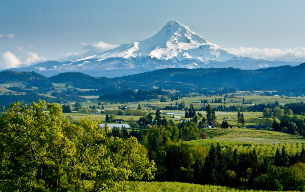
Willamette Valley is Oregon’s largest and most important agricultural valley, stretching through the western part of the state between the Coast Range and Cascade Range. The broad valley combines fertile farmland, vineyards, forests, rivers, wetlands, small communities, and some of Oregon’s largest cities.
The region is especially known for its wine industry, productive farmland, mild climate, and strong connection to Oregon’s history. From Portland in the north to communities around Eugene in the south, the valley offers a mixture of urban areas, rural landscapes, historic sites, and outdoor destinations.
| Fact | Details |
|---|---|
| Location | Western Oregon, United States |
| Country | United States |
| Region | Pacific Northwest |
| Elevation | Near sea level in the north to about 450 feet in the southern valley |
| Famous For | Wine, agriculture, fertile soils, rivers and scenic countryside |
| Climate | Mild, wet winters and warm, dry summers |
| Main River | Willamette River |
| Best Months | May through October |
| Nearby Cities/Towns | Portland, Salem, Corvallis, Albany and Eugene |
Where Is Willamette Valley?
Willamette Valley is located in northwestern Oregon between the Coast Range to the west and the Cascade Range to the east. It extends for roughly 150 miles from the Columbia River south toward the Calapooya Divide near Cottage Grove.
The valley includes or is closely associated with major Oregon communities such as Portland, Salem, Corvallis, Albany, Eugene, and Springfield. Interstate 5 runs through much of the valley, making it one of the most accessible regions in Oregon.
Geography and Landscape
The Willamette Valley is a relatively flat alluvial basin surrounded by mountains and foothills. Its floor gradually rises from near sea level around the Columbia River to roughly 450 feet south of Cottage Grove.
The Willamette River is the valley’s central waterway, joined by tributaries including the McKenzie, Santiam, Tualatin, Yamhill, Molalla, and Calapooia rivers. Fertile floodplain soils support extensive agriculture, while surrounding hills contain forests, vineyards, grasslands, and scattered basalt formations.
The valley’s landscape was also shaped by Ice Age flooding. Massive Missoula Floods entered from the Columbia River system and temporarily backed water into the Willamette Basin, leaving behind sediments and isolated hills that remain visible today.
History of Willamette Valley
The valley has been home to Indigenous peoples for thousands of years, including numerous Kalapuya communities and other Native peoples connected with the wider Willamette Basin. Indigenous land management included controlled burning, which helped maintain open prairies, oak savannas, and other habitats.
Non-Indigenous exploration and settlement increased during the nineteenth century. Fur traders, missionaries, and American settlers were followed by large numbers of immigrants arriving during the 1840s and 1850s. Oregon City, Salem, Portland, Albany, and Eugene developed as important communities along the valley’s rivers and transportation routes.
Agriculture quickly became central to the regional economy. Wheat and other crops benefited from fertile soils, while river transportation connected farms with Portland and markets beyond Oregon. Over time, the valley diversified into livestock, nurseries, berries, grass seed, vegetables, and vineyards.
The region’s agricultural character continues today, although urban development has transformed large portions of the historic landscape. Conservation efforts increasingly focus on restoring wetlands, oak habitats, prairie, rivers, and wildlife corridors.
How Was Willamette Valley Formed?
Willamette Valley developed as a broad geological basin between the Coast and Cascade ranges. Over long periods, rivers deposited sediments across the lowlands, creating fertile alluvial soils.
Ice Age floods were also important. Floodwaters originating far to the northeast moved through the Columbia River system and temporarily entered the Willamette Basin, depositing layers of sediment and reshaping the valley floor. Later river activity, erosion, and changing climate conditions continued to modify the landscape.
Willamette Valley Weather Throughout the Year
The Willamette Valley has a Mediterranean-influenced climate characterized by mild, wet winters and warm, relatively dry summers. Conditions vary somewhat from north to south and between the valley floor and surrounding foothills.
January to March
Winter is cool, cloudy, and wet. Daytime temperatures generally remain moderate, while nights can be chilly. Rain is much more common than snow on the valley floor, although colder weather can occasionally bring snowfall.
April to June
Spring becomes progressively warmer while rainfall gradually decreases. April and May often bring a mixture of showers and sunny periods, followed by warmer conditions in June. The countryside is especially green during this period, and agricultural areas become active with spring growth.
July to September
Summer is the warmest and driest part of the year. Daytime temperatures commonly reach the upper 70s or 80s Fahrenheit, with occasional hotter periods. Rainfall is limited, producing long stretches of dry weather that are well suited to outdoor recreation and vineyard visits.
October to December
Autumn begins with mild temperatures before cooler and wetter conditions return. October can still offer pleasant days, while November and December typically bring more frequent rainfall. Snow remains uncommon on the valley floor.
Best Weather for Visiting Willamette Valley
May through October generally offers the most comfortable combination of mild temperatures, drier weather, outdoor accessibility, and scenic landscapes. Summer is particularly reliable for outdoor activities, while spring and autumn provide cooler conditions and seasonal scenery.
Things to Do in Willamette Valley
- Visit vineyards and wineries: Wine tasting is one of the region’s signature experiences, particularly in the northern and central valley.
- Cycle scenic routes: The Willamette Valley Scenic Bikeway provides opportunities to explore rural landscapes by bicycle.
- Hike and explore parks: Trails range from easy valley walks to forested routes and waterfall hikes.
- Explore local farms: Farm stands, farmers markets, berry farms, and agricultural experiences highlight the valley’s food-producing heritage.
- Paddle local waterways: The Willamette River and nearby lakes and tributaries provide opportunities for kayaking, canoeing, and other water activities.
- Visit historic communities: Salem, Albany, and smaller valley towns offer museums, historic buildings, cultural sites, and local downtown districts.
Famous Attractions in and Around Willamette Valley
Oregon State Capitol
Located in Salem, the Oregon State Capitol is an important architectural and political landmark and provides insight into the state’s government and history.
Willamette Valley Scenic Bikeway
This long-distance route follows roads and communities through the valley and highlights farmland, rivers, historic towns, and rural scenery.
Silver Falls State Park
Near Silverton, Silver Falls State Park is known for its forested trails and concentration of waterfalls, including the popular Trail of Ten Falls.
Champoeg State Heritage Area
Located along the Willamette River, Champoeg preserves an important site in Oregon’s early political history and offers trails, open landscapes, and a visitor center.
Marys Peak
Near Corvallis, Marys Peak is the highest point in Oregon’s Coast Range and provides views across the Willamette Valley and surrounding mountains on clear days.
Wooden Shoe Tulip Farm
Near Woodburn, this seasonal agricultural attraction is known for extensive tulip fields and springtime events.
Evergreen Aviation & Space Museum
Located in McMinnville, the museum features major aviation and space exhibits, including historic aircraft and aerospace displays.
Wildlife and Nature
The Willamette Valley supports a mixture of wetlands, rivers, oak habitats, grasslands, forests, and agricultural landscapes. The Willamette River and its tributaries provide important habitat for fish and other aquatic species, while wetlands and wildlife refuges support numerous birds.
Commonly associated wildlife includes deer, beavers, river otters, coyotes, foxes, waterfowl, raptors, and songbirds. Native oak woodlands and prairies are particularly important conservation habitats because much of the valley’s historic open landscape has been converted to agriculture or urban development.
Protected areas such as the Willamette Valley National Wildlife Refuge Complex and several state parks help preserve remaining wetlands, prairies, forests, and river habitats.
How to Reach Willamette Valley
The valley is one of Oregon’s easiest regions to access. Interstate 5 runs north-south through the area and connects Portland with Salem, Albany, Corvallis-area routes, Eugene, and communities farther south.
Portland International Airport is the principal major airport for the northern valley, while Eugene Airport provides convenient access to the southern portion. Amtrak rail service connects several Willamette Valley communities, and regional bus services provide additional transportation options.
Where to Stay Near Willamette Valley
Accommodation is spread throughout the valley rather than concentrated in one destination. Portland, Salem, Eugene, Corvallis, Albany, and McMinnville provide the widest selection of hotels and guesthouses.
Wine-country areas also offer boutique inns, vineyard accommodations, bed-and-breakfast properties, and vacation rentals. Rural parts of the valley have farm stays and cabins, while state parks and other outdoor areas provide camping opportunities.
Why Is Willamette Valley Famous?
Willamette Valley is famous for its fertile agricultural land, internationally recognized wine industry, mild climate, Willamette River, scenic countryside, and important role in Oregon’s history. Its combination of farms, vineyards, forests, cities, and protected natural areas gives the region a distinctive identity within the Pacific Northwest.
Willamette Valley FAQs
Where is Willamette Valley located?
Willamette Valley is in western Oregon between the Coast Range and Cascade Range. It stretches from the Columbia River south toward the Calapooya Divide.
What is Willamette Valley famous for?
The valley is particularly known for agriculture and wine production, especially its Pinot Noir vineyards. It is also recognized for its rivers, fertile landscapes, forests, and historic communities.
What is the weather like in Willamette Valley?
The climate features mild, wet winters and warm, dry summers. Summer is generally the driest season, while most of the annual rainfall occurs during the cooler months.
What are the best months to visit Willamette Valley?
May through October generally provides the most favorable weather for sightseeing and outdoor activities. Spring is popular for flowers and farmland scenery, while autumn brings harvest-season interest.
What can you do in Willamette Valley?
Visitors can explore wineries, hike in forests and parks, cycle scenic routes, visit farms and historic sites, paddle waterways, and explore towns throughout the region.
How do you reach Willamette Valley?
Interstate 5 provides the main north-south road connection. Portland and Eugene have major airports, while Amtrak and regional bus services connect several communities.
Does Willamette Valley get snow?
Snow is possible during winter but is generally limited on the valley floor. The surrounding Cascade and Coast Range mountains receive substantially more snow at higher elevations.
Final Thoughts
Willamette Valley offers a varied landscape where agriculture, wine country, rivers, forests, historic communities, and protected natural areas come together. Its accessible location and mild climate make it a distinctive Oregon destination for travelers interested in scenery, food, outdoor recreation, and regional history.
For More Visit Stay And Update
